
Kettenbach
| Aarbergen | ||
|---|---|---|
|
||

Aarbergen
|
||
|
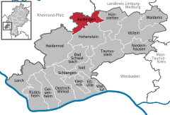
Location of Aarbergen within Rheingau-Taunus-Kreis district
  |
||
| Coordinates: 50°15′0″N 8°4′0″E / 50.25000°N 8.06667°ECoordinates: 50°15′0″N 8°4′0″E / 50.25000°N 8.06667°E | ||
| Country | Germany | |
| State | Hesse | |
| Admin. region | Darmstadt | |
| District | Rheingau-Taunus-Kreis | |
| Government | ||
| • Mayor | Udo Scheliga (CDU) | |
| Area | ||
| • Total | 33.94 km2 (13.10 sq mi) | |
| Elevation | 230 m (750 ft) | |
| Population (2015-12-31) | ||
| • Total | 6,006 | |
| • Density | 180/km2 (460/sq mi) | |
| Time zone | CET/CEST (UTC+1/+2) | |
| Postal codes | 65326 | |
| Dialling codes | 06120 | |
| Vehicle registration | RÜD | |
| Website | www.aarbergen.de | |

Aarbergen is a community in the Rheingau-Taunus-Kreis in the Regierungsbezirk of Darmstadt in Hesse, Germany.
Aarbergen lies on the river Aar south of Limburg an der Lahn and between the Taunus ridge and the river Lahn in the Western Hintertaunus ("Farther Taunus").
The community is found in the low mountain landscape in the western Hintertaunus, which is part of the Rhenish Massif (Rhenish Slate Mountains). The heights are characterized by a pronounced peak-and-trough surface relief, parts of which show formations from deep in the ground (kaolin). The surface relief had valleys carved deeply into it in the Quaternary by the Aar and its tributaries. Underground, the rock is formed mainly out of the Rhenish Slate Mountains’ Lower Devonian shale, metamorphic sandstone and quartzite. On top are found, often several metres deep, great layers of periglacial deposits much of which contains carbonate-free to weakly carbonate loess loam. Oligocene shingle (Vallendar facies) overlies the older surface near Kettenbach and Hausen über Aar.
Well known in professional circles are the occurrences of soil erosion (gullies and similar channels) in broad parts of the community which began in historical times. The landscape in the community’s municipal area is characterized by the middle Aar valley with its side valleys. The greater part of the municipal area is wooded. The main land use in open areas is field crops. In the valleys is meadowland, sometimes with scenically valuable meadow orchards (Streuobstwiesen). The Aubach, the Aar’s biggest tributary, empties into that river within community limits, as does the Bettenbach.
...
Wikipedia