Keosauqua, Iowa
| Keosauqua, Iowa | |
|---|---|
| City | |

Keosauqua welcome sign
|
|
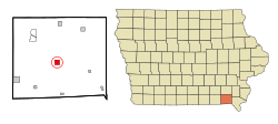
 Location of Keosauqua, Iowa |
|
| Coordinates: 40°43′56″N 91°57′47″W / 40.73222°N 91.96306°WCoordinates: 40°43′56″N 91°57′47″W / 40.73222°N 91.96306°W | |
| Country |
|
| State |
|
| County | Van Buren |
| Area | |
| • Total | 1.57 sq mi (4.07 km2) |
| • Land | 1.45 sq mi (3.76 km2) |
| • Water | 0.12 sq mi (0.31 km2) |
| Elevation | 584 ft (178 m) |
| Population (2010) | |
| • Total | 1,006 |
| • Estimate (2012) | 993 |
| • Density | 693.8/sq mi (267.9/km2) |
| Time zone | Central (CST) (UTC-6) |
| • Summer (DST) | CDT (UTC-5) |
| ZIP code | 52565 |
| Area code(s) | 319 |
| FIPS code | 19-40935 |
| GNIS feature ID | 0458057 |
Keosauqua (/ˌkiːəˈsɔːkwə/ KEE-ə-SAW-kwə) is a city in Van Buren County, Iowa, United States. The population was 1,006 at the 2010 census. It is the county seat of Van Buren County.
Keosauqua was laid out in 1839. The word Keosauqua derives from the Meskwaki and Sauk name for the Des Moines River, "Ke-o-saw-qua", which literally translates as "Bend in the River". The Hotel Manning, a three story relic from the Des Moines River's steamboat days, is Keosauqua's most notable landmark. Also located in Keosauqua are many other notable historic sites. The 1847 Pearson House was a stop on the underground railroad.
The Honey War was fought south of Keosauqua in what is now Lacey-Keosauqua State Park. Lacey-Keosauqua is one of the largest state parks in Iowa and was built by the Civil Conservation Corps during the Great Depression. Keosauqua hosts its annual Fall Festival the second full weekend in October.
...
Wikipedia
