Kenton, Ohio
| Kenton, Ohio | |
|---|---|
| City | |

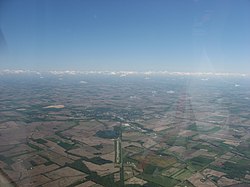
Aerial view of Kenton from the southwest
|
|
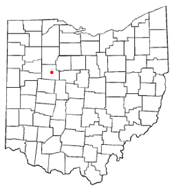
 Location of Kenton, Ohio |
|
 Location of Kenton in Hardin County |
|
| Coordinates: 40°38′48″N 83°36′31″W / 40.64667°N 83.60861°WCoordinates: 40°38′48″N 83°36′31″W / 40.64667°N 83.60861°W | |
| Country | United States |
| State | Ohio |
| County | Hardin |
| Government | |
| • Mayor | Randy Manns |
| Area | |
| • Total | 5.13 sq mi (13.29 km2) |
| • Land | 5.04 sq mi (13.05 km2) |
| • Water | 0.09 sq mi (0.23 km2) |
| Elevation | 991 ft (302 m) |
| Population (2010) | |
| • Total | 8,262 |
| • Estimate (2012) | 8,195 |
| • Density | 1,639.3/sq mi (632.9/km2) |
| Time zone | Eastern (EST) (UTC-5) |
| • Summer (DST) | EDT (UTC-4) |
| ZIP code | 43326 |
| Area code(s) | 419 567 |
| FIPS code | 39-39886 |
| GNIS feature ID | 1064929 |
| Website | http://www.kentoncity.com/ |
Kenton is a city in and the county seat of Hardin County, Ohio, United States, located in the west central part of Ohio. The population was 8,262 at the 2010 census. The city was named for frontiersman Simon Kenton of Kentucky and Ohio.
Kenton is located at 40°38′48″N 83°36′31″W / 40.64667°N 83.60861°W (40.646555, -83.608706).
According to the United States Census Bureau, the city has a total area of 5.13 square miles (13.29 km2), of which, 5.04 square miles (13.05 km2) is land and 0.09 square miles (0.23 km2) is water.
In 1845, Kenton was incorporated as a village; it became a city in 1886. The city was named after frontiersman Simon Kenton.
The city began as a center for agriculture trade, then in the late nineteenth century developed industry common to America of the time. From 1890 to 1952, Kenton was home to the Kenton Hardware Company, manufacturers of locks, cast-iron toys, and the very popular Gene Autry toy cap guns.
As of the census of 2010, there were 8,262 people, 3,351 households, and 2,092 families residing in the city. The population density was 1,836 persons per square mile (712.2/km²). There were 3,773 housing units at an average density of 838.4 per square mile (325.3/km²). The racial makeup of the city was 96.2% White, 0.9% African American, 0.2% Native American, 0.3% Asian, 0.9% from other races, and 1.4% from two or more races. Hispanic or Latino of any race were 0.90% of the population.
...
Wikipedia
