Kell, Illinois
| Kell | |
| Village | |
| Country | United States |
|---|---|
| State | Illinois |
| County | Marion |
| Elevation | 603 ft (184 m) |
| Coordinates | 38°29′27″N 88°54′22″W / 38.49083°N 88.90611°WCoordinates: 38°29′27″N 88°54′22″W / 38.49083°N 88.90611°W |
| Area | 1.01 sq mi (3 km2) |
| - land | 1.01 sq mi (3 km2) |
| - water | 0.00 sq mi (0 km2) |
| Population | 231 (2000) |
| Density | 228.7/sq mi (88/km2) |
| Timezone | CST (UTC-6) |
| - summer (DST) | CDT (UTC-5) |
| Postal code | 62853 |
| Area code | 618 |
|
Location in Marion County and the state of Illinois.
|
|
|
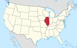
Location of Illinois in the United States
|
|
Kell is a village in Marion County, Illinois, United States. The population was 231 at the 2000 census.
Kell is located at 38°29′27″N 88°54′22″W / 38.49083°N 88.90611°W (38.490869, -88.906241).
According to the 2010 census, Kell has a total area of 1.012 square miles (2.62 km2), of which 1.01 square miles (2.62 km2) (or 99.8%) is land and 0.002 square miles (0.01 km2) (or 0.2%) is water.
Kell is located near the divide between the Mississippi and Ohio Rivers. Casey Creek, a tributary of the Big Muddy and Mississippi Rivers, runs through the middle of town. Casey Creek originates just to the north of Kell. The Ohio/Mississippi divide is just east of Kell. The water tower sits atop this prominent ridge. Panther Fork, a tributary of the Little Wabash, Wabash and Ohio Rivers has its origin just over the ridge.
Kell is also located on the divide between the Big Muddy and Kaskaskia Rivers, both tributaries of the Mississippi. The divide between the Casey Creek/Big Muddy Basin and the Kaskaskia Basin is about 1,000 feet (300 m) west of town, over a rise that is barely noticeable.
Today Kell is located on Kell Road, a road that serves Kell, but seems to go nowhere, and comes from nowhere. There is an elevator and a rail line there, but these were built long after the settlement was founded. One might therefore ask: why did Kell ever come into existence?
The answer may lie in Kell's location at the junction of the Kaskaskia/Big Muddy/Ohio Divides. Before there were bridges, pioneer roads tended to follow the ridges, or divides, between watersheds. Along these ridges there were only small creeks that could be easily crossed, often without even getting one's feet wet. At the junction of two divides, Kell was a natural intersection for pioneer roads.
...
Wikipedia


