Kazan Metro
 |
|||

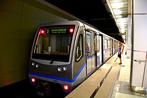
Train made up of 81-740/741 cars at the station Kozya Sloboda
|
|||
| Overview | |||
|---|---|---|---|
| Native name | Казанский метрополитен Kazansky metropoliten Казан метрополитены Qazan Metropolitenı |
||
| Owner | Municipality of Kazan | ||
| Locale | Kazan, Republic of Tatarstan, Russia | ||
| Transit type | Rapid transit | ||
| Number of lines | 1 | ||
| Number of stations | 10 | ||
| Daily ridership | 86 thousand (average) | ||
| Annual ridership | 31,3 million (2013) | ||
| Operation | |||
| Began operation | 2005 | ||
| Operator(s) | MetroElektroTrans | ||
| Number of vehicles | 47 | ||
| Technical | |||
| System length | 15.822 km (9.8 mi) | ||
| Track gauge | 1,524 mm (5 ft) | ||
|
|||
Kazan Metro (Russian: Каза́нское метро́; Tatar: Казан метросы Tatar Latin: Qazan metrosı) is a rapid-transit system that serves the city of Kazan, Republic of Tatarstan, Russia. The metro system was the seventh opened in Russia, and the fifteenth in the former Soviet Union region. Opened on August 27, 2005, it is the newest system in Russia.
Kazan is a historic and cultural centre on the middle Volga. The first plans to have a rapid-transit system were proposed back in the days of the Russian Empire, but after the October Revolution and the Russian Civil War little was left for the design. Nevertheless, in the 1930s, Kazan, being the capital of the Tatar ASSR—one of the most visible autonomous republics and rapidly growing as an industrial centre—prompted some to propose a rapid transit system for the future, particularly after the successful construction of Moscow Metro in 1935.
However, World War II ended such attempts, and in the post-war USSR only the largest capitals of Union republics could afford a Metro system. Nevertheless, in 1979 the Kazan city's population passed the one million mark: a Soviet requirement for a Metro to be allowed. 1983 was the year when the Supreme Soviet of the Tatar ASSR authorised planning a metro system. The original design was to prove the final, as the City of Kazan effectively followed a typical Soviet model with a historical centre on the inflow of the Kazanka River into the Volga, and the various industrial and "bedroom" districts (housing complexes) on the edges. The first line would follow a north-south axis beginning in the Transit Railway Station in the north, passing through the post-war Stalinist buildings and then down south of the Kazanka, next to the Kazan Kremlin and through the historical centre to the microdistrict of Gorki.
...
Wikipedia
