Kawaba, Gunma
|
Kawaba 川場村 |
|||
|---|---|---|---|
| Village | |||

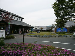
Road station Kawaba Den-en Plaza
|
|||
|
|||
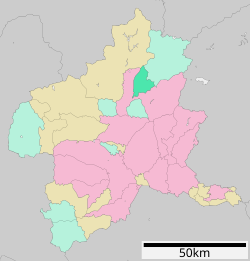
 Location of Kawaba in Gunma Prefecture |
|||
| Coordinates: 36°41′40.7″N 139°6′23.3″E / 36.694639°N 139.106472°ECoordinates: 36°41′40.7″N 139°6′23.3″E / 36.694639°N 139.106472°E | |||
| Country | Japan | ||
| Region | Kantō | ||
| Prefecture | Gunma Prefecture | ||
| District | Tone | ||
| Area | |||
| • Total | 85.25 km2 (32.92 sq mi) | ||
| Population (February 2015) | |||
| • Total | 3,687 | ||
| • Density | 43.2/km2 (112/sq mi) | ||
| Time zone | Japan Standard Time (UTC+9) | ||
| Phone number | 0278-52-2111 | ||
| Address | 2390-2 Ōaza Tanichi, Kawaba-mura, Tone-gun, Gunma-ken 378-0101 | ||
| Website | Official website | ||
Kawaba (川場村 Kawaba-mura?) is a village located in Tone District of central Gunma Prefecture in the northern Kantō region of Japan. As of February 2015, the village had an estimated population of 3,687 and a population density of 43.2 persons per km². Its total area was 85.25 km².
Located in north-central Gunma, Kawaba is in a mountainous area. Approximately 83% of its area is covered by forests, and five rivers (the Tashiro, Sakura, Tazawa, Usune, and the Mizomata) flow through the village. Kawaba, meaning "the place of the rivers" is thought to be named after its many streams. The climate is cool, with an average yearly temperature of 11.0℃ and a snowfall of two-three meters.
The area of present-day Kawaba was part of the holdings of Numata Domain in Kōzuke Province during the Edo period. On April 1, 1889 with the creation of the municipalities system after the Meiji Restoration, Kawaba village was established within Tone District, Gunma. In 2002, a proposal to merge Kawaba into neighboring Numata was opposed by young local politicians, who instead proposed that the village be merged with its sister city, Setagaya, Tokyo. However, this proposal was strongly opposed by the Gunma prefectural government and met with lukewarm response from Setagaya, and the village remained independent.
...
Wikipedia


