Kaufman, TX
| Kaufman, Texas | |
|---|---|
| City | |
| Motto(s): "Progress, Tradition" | |
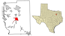
 Location of Kaufman in Kaufman County, Texas |
|
| Coordinates: 32°35′7″N 96°18′28″W / 32.58528°N 96.30778°WCoordinates: 32°35′7″N 96°18′28″W / 32.58528°N 96.30778°W | |
| Country | United States |
| State | Texas |
| County | Kaufman |
| Government | |
| Area | |
| • Total | 6.8 sq mi (17.7 km2) |
| • Land | 6.6 sq mi (17.2 km2) |
| • Water | 0.2 sq mi (0.5 km2) |
| Elevation | 459 ft (140 m) |
| Population (2000) | |
| • Total | 6,490 |
| • Density | 977.9/sq mi (377.6/km2) |
| Time zone | Central (CST) (UTC-6) |
| • Summer (DST) | CDT (UTC-5) |
| ZIP code | 75142 |
| Area code(s) | 214, 469, 972 |
| FIPS code | 48-38488 |
| GNIS feature ID | 1338964 |
| Website | http://www.kaufmantx.org/ |
Kaufman is a city in Kaufman County, Texas, United States. The population was 6,703 at the 2010 census. It is the county seat of Kaufman County.
Kaufman was founded as a fort, named after Dr. William P. King who established the fort after purchasing 2.5 square miles of land where the city is now located in 1840. Kings Fort was renamed Kingsboro after five years of growth. In 1852, Kingsboro was renamed Kaufman after the newly formed Kaufman County, which in turn was named after David S. Kaufman. Kaufman was the first place that Bonnie Parker, of Bonnie and Clyde fame, was incarcerated.
Nearby Camp Kaufman was used as a German POW camp during World War II.
Kaufman is located at 32°35′7″N 96°18′28″W / 32.58528°N 96.30778°W (32.585395, -96.307673).
According to the United States Census Bureau, the city has a total area of 6.8 square miles (18 km2), of which, 6.6 square miles (17 km2) of it is land and 0.2 square miles (0.52 km2) of it (2.64%) is water.
As of 2010 Kaufman had a population of 6,703. The median age was 32. The ethnic and racial composition of the population was 55.4% non-Hispanic white, 9.4% non-Hispanic black, 0.9% Native American, 0.9% Asian, 13.6% reporting some other race and 3.5% from two or more races. 32.6% of the population was Hispanic or Latino of any race.
As of the census of 2000, there were 6,490 people, 2,179 households, and 1,579 families residing in the city. The population density was 977.9 people per square mile (377.4/km²). There were 2,310 housing units at an average density of 348.1 per square mile (134.3/km²). The racial makeup of the city was 47.83% White, 12.87% African American, 0.66% Native American, 0.42% Asian, 15.92% from other races, and 2.31% from two or more races. Hispanic or Latino of any race were 39.74% of the population.
...
Wikipedia
