Karmøy
| Karmøy kommune | |||
|---|---|---|---|
| Municipality | |||

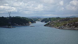
View of the Låvesundet
|
|||
|
|||
 Karmøy within Rogaland |
|||
| Coordinates: 59°15′23″N 05°14′57″E / 59.25639°N 5.24917°ECoordinates: 59°15′23″N 05°14′57″E / 59.25639°N 5.24917°E | |||
| Country | Norway | ||
| County | Rogaland | ||
| District | Haugaland | ||
| Administrative centre | Kopervik | ||
| Government | |||
| • Mayor (2015) | Jarle Nilsen (Ap) | ||
| Area | |||
| • Total | 229.90 km2 (88.76 sq mi) | ||
| • Land | 219.43 km2 (84.72 sq mi) | ||
| • Water | 10.47 km2 (4.04 sq mi) | ||
| Area rank | 315 in Norway | ||
| Population (2015) | |||
| • Total | 42,062 | ||
| • Rank | 20 in Norway | ||
| • Density | 191.7/km2 (497/sq mi) | ||
| • Change (10 years) | 12% % | ||
| Demonym(s) | Karmøybu Kartabu |
||
| Time zone | CET (UTC+1) | ||
| • Summer (DST) | CEST (UTC+2) | ||
| ISO 3166 code | NO-1149 | ||
| Official language form | Neutral | ||
| Website | www |
||
|
|
|||
Karmøy is a municipality in Rogaland county, Norway. It is located southwest of the city of Haugesund in the traditional district of Haugaland. The administrative centre of the municipality is the town of Kopervik.
Karmøy is one of the largest municipalities in the region with over 42,000 people. It is known for its industries, as well as for fishing. Karmøy is also well known in Norway for its beautiful heather moors and the white sand surfing beaches.
Most of the municipality lies on the island of Karmøy. The island is connected to the mainland by the Karmøy Tunnel and the Karmsund Bridge.
The municipality of Karmøy is a recent creation. It was created as a new municipality on 1 January 1965 upon the merger of two towns and parts of five municipalities into one large municipality. The merger was instigated by the findings of the Schei Committee. Karmøy was the result of merging the towns of Kopervik and Skudeneshavn plus the neighboring municipalities of Skudenes, Stangaland, Åkra, and most of Avaldsnes and Torvastad. Initially, the municipality had 23,217 residents.
The municipality was named after the island of Karmøy, on which the majority of the municipality is located. The Old Norse form of the name was Kǫrmt. The name is probably derived from karmr which means "bargeboard" (here in the sense "the sheltering island"). The last element in the word, øy, means "island" and was added later.
...
Wikipedia


