Karasjok
|
Karasjok kommune Kárášjoga gielda Kaarasjoki |
|||
|---|---|---|---|
| Municipality | |||
 |
|||
|
|||
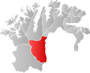
 Karasjok within Finnmark |
|||
| Coordinates: 69°28′55″N 25°6′18″E / 69.48194°N 25.10500°ECoordinates: 69°28′55″N 25°6′18″E / 69.48194°N 25.10500°E | |||
| Country | Norway | ||
| County | Finnmark | ||
| Administrative centre | Karasjok | ||
| Government | |||
| • Mayor (2015) | Svein Atle Somby (Ap) | ||
| Area | |||
| • Total | 5,452.94 km2 (2,105.39 sq mi) | ||
| • Land | 5,209.45 km2 (2,011.38 sq mi) | ||
| • Water | 243.49 km2 (94.01 sq mi) | ||
| Area rank | 2 in Norway | ||
| Population (2014) | |||
| • Total | 2,698 |
||
| • Rank | 287 in Norway | ||
| • Density | 0.49/km2 (1.3/sq mi) | ||
| • Change (10 years) | -5.8 % | ||
| Demonym(s) | Karasjoking | ||
| Time zone | CET (UTC+1) | ||
| • Summer (DST) | CEST (UTC+2) | ||
| ISO 3166 code | NO-2021 | ||
| Official language form |
Bokmål and Northern Sami |
||
| Website | www |
||
|
|
|||
| Karasjok | ||||||||||||||||||||||||||||||||||||||||||||||||||||||||||||
|---|---|---|---|---|---|---|---|---|---|---|---|---|---|---|---|---|---|---|---|---|---|---|---|---|---|---|---|---|---|---|---|---|---|---|---|---|---|---|---|---|---|---|---|---|---|---|---|---|---|---|---|---|---|---|---|---|---|---|---|---|
| Climate chart () | ||||||||||||||||||||||||||||||||||||||||||||||||||||||||||||
|
||||||||||||||||||||||||||||||||||||||||||||||||||||||||||||
|
||||||||||||||||||||||||||||||||||||||||||||||||||||||||||||
| J | F | M | A | M | J | J | A | S | O | N | D |
|
18
−12
−23
|
13
−10
−22
|
14
−4
−17
|
15
1
−9
|
23
7
−1
|
42
15
5
|
71
18
8
|
58
15
6
|
40
9
2
|
33
2
−5
|
22
−5
−14
|
17
−10
−21
|
| Average max. and min. temperatures in °C | |||||||||||
| Precipitation totals in mm | |||||||||||
| Source: eklima | |||||||||||
| Imperial conversion | |||||||||||
|---|---|---|---|---|---|---|---|---|---|---|---|
| J | F | M | A | M | J | J | A | S | O | N | D |
|
0.7
11
−10
|
0.5
14
−7
|
0.6
24
2
|
0.6
35
16
|
0.9
45
31
|
1.7
58
42
|
2.8
64
47
|
2.3
59
43
|
1.6
49
35
|
Wikipedia
...
| ||


