Kangaroo Island
| Native name: Karta (Island of the Dead) | |
|---|---|

Map of Kangaroo Island
|
|
| Geography | |
| Location | South Australia |
| Coordinates | 35°50′S 137°15′E / 35.833°S 137.250°E |
| Area | 4,405 km2 (1,701 sq mi) |
| Length | 150 km (93 mi) |
| Width | 90 km (56 mi) – 57 km (35 mi) |
| Coastline | 540 km (336 mi) |
| Highest elevation | 299 m (981 ft) |
| Highest point | Mount Macdonnell |
| Administration | |
|
Australia
|
|
| State | South Australia |
| LGA | Kangaroo Island Council |
| Largest settlement | Kingscote (pop. 2,034) |
| Demographics | |
| Population | 4,417 (2011) |
| Pop. density | 1.00 /km2 (2.59 /sq mi) |
| Kangaroo Island Stratigraphic range: Cambrian Stage 4("Lower Cambrian") |
|
|---|---|

North Coast of Kangaroo Island, Emu Bay
© David Simpson |
|
| Type | Geological formation |
| Lithology | |
| Primary | Shale |
| Location | |
| Coordinates | 35°35′S 137°30′E / 35.583°S 137.500°E |
| Region | The north coast of Kangaroo Island, around Emu Bay and Cape D'Estaing |
| Country | South Australia, Australia. |
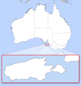
Kangaroo Island is Australia's third-largest island, after Tasmania and Melville Island. It lies in the state of South Australia 112 km (70 mi) southwest of Adelaide. Its closest point to the mainland is Snapper Point in Backstairs Passage which is 13.5 km (8.4 mi) from the Fleurieu Peninsula.
Once occupied by Australian Aborigines, the native population disappeared after the land became an island following rising sea levels several thousand years ago. It was subsequently resettled from the early 19th century onwards, at first casually by sealers and whalers, and then as part of the colony of South Australia from 1836.
Since then the island's economy has been principally agricultural, with a southern rock lobster fishery and with tourism growing in importance. The largest town, and the administrative centre, is Kingscote. The island has several nature reserves to protect the remnants of its natural vegetation and native animals, with the largest and best-known being Flinders Chase National Park at the western end.
The island is 150 km (93 mi) long and between 90 km (56 mi) and 57 km (35 mi) wide, its area covering 4,405 km2 (1,701 sq mi). Its coastline is 540 kilometres (340 mi) long and highest point is Mount McDonnell at 299 m (981 ft) above sea level. It is separated from Yorke Peninsula to the northwest by Investigator Strait and from Fleurieu Peninsula to the northeast by Backstairs Passage. A group of islets, the Pages, lie off the eastern end of the island.
...
Wikipedia

