Kamwookya
| Kamwookya | |
|---|---|
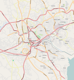
| Map of Kampala showing the location of Kamwookya. | |
| Coordinates: 00°20′33″N 32°35′20″E / 0.34250°N 32.58889°ECoordinates: 00°20′33″N 32°35′20″E / 0.34250°N 32.58889°E | |
| Country |
|
| Region | Central Uganda |
| District | Kampala Capital City Authority |
| Division | Kampala Central Division |
| Elevation | 1,200 m (3,900 ft) |
| Time zone | EAT (UTC+3) |
Kamwookya, sometimes spelled as Kamwokya, is a location within the city of Kampala, Uganda's capital and largest metropolitan area.
Kamwookya is bordered by Kyebando to the north, Bukoto to the northeast, Naguru to the east, Kololo to the southeast, Nakasero to the south and Mulago to the west. This location is approximately 5 kilometres (3.1 mi), by road, northeast of the Kampala's central business district. The coordinates of Kamwookya are:0°20'33.0"N, 32°35'20.0"E (Latitude:0.342500; Longitude:32.588889).
Kamwookya is a mixed residential and commercial area of the city, with a large number of small Information Technology (IT) businesses. Kamwookya is also the location of a central market, restaurants, shops, dry-cleaners and sports bars, many of them, upscale. Closer to the city center, one can find several foreign embassies, government buildings and an upscale shopping mall. (See Points of interest below:).
In the northern portion of Kamwookya, between the Kampala Northern Bypass Highway and Kira Road, the neighborhood is a densely packed slum, with poorly constructed housing units, poor drainage and rudimentary sanitary infrastructure, with attendant public health challenges.
The points of interest in or near Kamwookya include:
...
Wikipedia

