Bukoto
| Bukoto | |
|---|---|
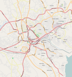
| Map of Kampala showing the location of Bukoto. | |
| Coordinates: 00°21′04″N 32°35′47″E / 0.35111°N 32.59639°ECoordinates: 00°21′04″N 32°35′47″E / 0.35111°N 32.59639°E | |
| Country |
|
| Region | Central Uganda |
| District | Kampala Capital City Authority |
| Division | Kampala Central Division |
| Elevation | 1,200 m (3,900 ft) |
| Time zone | EAT (UTC+3) |
Bukoto is a township within the city of Kampala, Uganda's capital and largest metropolitan area.
Bukoto is bordered by Kisaasi to the north, Kigoowa to the north-east, Ntinda to the east, Naguru to the south-east, Kololo to the south, Kamwookya to the west, and Kyebando to the north-west. This location is approximately 7 kilometres (4.3 mi), by road, north-east of Kampala's central business district. The coordinates of Bukoto are 0°21'04.0"N, 32°35'47.0"E (Latitude:0.351111; Longitude:32.596400).
The following points of interest lie inside or near Bukoto:
...
Wikipedia

