Kamenny Island
| Каменные острова | |
|---|---|

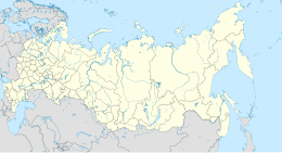
Map of Kronstadt bay with the Kamenny Islands on the right side
|
|
| Geography | |
| Location | Gulf of Finland |
| Coordinates | 59°59′N 30°17′E / 59.98°N 30.29°ECoordinates: 59°59′N 30°17′E / 59.98°N 30.29°E |
| Archipelago | Kamenny Islands |
| Total islands | 3 |
| Area | 5.4 km2 (2.1 sq mi) |
| Length | 5.3 km (3.29 mi) |
| Width | 1.9 |
| Highest elevation | 18 m (59 ft) |
| Administration | |
| Region | Saint Petersburg |
Kamenny Islands (Russian: Каменные острова, Kamenny Ostrova, meaning 'Stony Islands') are a group of three islands in the Neva delta, Russian Federation.
The three islands are flat. They are divided by channels and have bridges connecting each other, as well as the group with the mainland. The Kamenny Islands are part of the city of Saint Petersburg
Kamenny Island (Russian: Каменный остров, meaning 'Stone Island'), with an area of 1.06 km², it is the easternmost island and gives its name to the group. It was renamed as Workers' Island (Russian: остров Трудящихся) in Soviet times. Since that era and to this day, government residences have been located on Kamenny Island.
Yelagin Island (Russian: Елагин остров) lies in the centre/north, where the Yelagin Palace is located.
Krestovsky Island (Russian: Крестовский остров) is the westernmost and largest island. It is the location of the Kamenny Island Palace.
Peter the Great presented Kamenny Island to Count Gavriil Golovkin, Chancellor of the Russian Empire. After his family fell into disgrace, the island passed to his successor, Count Aleksei Petrovich Bestuzhev-Ryumin. A decade later, Empress Elizabeth granted it to the future Peter III of Russia.
...
Wikipedia

