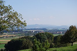
Kallern
| Kallern | ||
|---|---|---|
 |
||
|
||
| Coordinates: 47°19′N 8°18′E / 47.317°N 8.300°ECoordinates: 47°19′N 8°18′E / 47.317°N 8.300°E | ||
| Country | Switzerland | |
| Canton | Aargau | |
| District | Muri | |
| Area | ||
| • Total | 2.68 km2 (1.03 sq mi) | |
| Elevation | 513 m (1,683 ft) | |
| Population (Dec 2015) | ||
| • Total | 330 | |
| • Density | 120/km2 (320/sq mi) | |
| Postal code | 5625 | |
| SFOS number | 4233 | |
| Surrounded by | Bettwil, Boswil, Sarmenstorf, Uezwil, Waltenschwil | |
| Website |
www SFSO statistics |
|
Kallern is a municipality in the district of Muri in the canton of Aargau in Switzerland.
Kallern is first mentioned around 1303-08 as Kaltherren. During the Late Middle Ages, the major landowners in Kallern were Muri Abbey and Hilfikon. After 1415, the village belonged to Muri. Then, after 1435 it belonged to the district of Boswil in the Freie Ämter. Under the Helvetic Republic it was part of the Canton of Baden. Kallern, Ober- and Unterhöll and Uezwil formed a collective community. Niesenberg was connected to Bettwil. The Act of Mediation in 1803 led to the current community. In 1962, a chapel was built in Oberniesenberg, and in 1975 a school and multipurpose room were finished. In 1969, electric street lights came to the village and in 1970, a central water supply was added. In 1980 Hinterbühl was developed as a residential area, and in 1984 it was connected to the sewage treatment plant at Bünzen. In 2000 a quarter of the economically active population worked in agriculture and two thirds were commuters. At the beginning of the 21st Century Kallern possessed neither public transportation or shops.
Kallern, except for the hamlet of Oberniesenberg, belongs to the parish of Boswil-Kellern.
Kallern has an area, as of 2009[update], of 2.68 square kilometers (1.03 sq mi). Of this area, 2.08 km2 (0.80 sq mi) or 77.6% is used for agricultural purposes, while 0.36 km2 (0.14 sq mi) or 13.4% is forested. Of the rest of the land, 0.25 km2 (0.097 sq mi) or 9.3% is settled (buildings or roads).
Of the built up area, housing and buildings made up 4.9% and transportation infrastructure made up 4.5%. Out of the forested land, 11.6% of the total land area is heavily forested and 1.9% is covered with orchards or small clusters of trees. Of the agricultural land, 42.9% is used for growing crops and 32.1% is pastures, while 2.6% is used for orchards or vine crops.
...
Wikipedia


