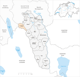
Bettwil
| Bettwil | ||
|---|---|---|
 |
||
|
||
| Coordinates: 47°18′N 8°16′E / 47.300°N 8.267°ECoordinates: 47°18′N 8°16′E / 47.300°N 8.267°E | ||
| Country | Switzerland | |
| Canton | Aargau | |
| District | Muri | |
| Area | ||
| • Total | 4.25 km2 (1.64 sq mi) | |
| Elevation | 688 m (2,257 ft) | |
| Population (Dec 2015) | ||
| • Total | 571 | |
| • Density | 130/km2 (350/sq mi) | |
| Postal code | 5618 | |
| SFOS number | 4227 | |
| Surrounded by | Boswil, Buttwil, Fahrwangen, Kallern, Sarmenstorf, Schongau (LU) | |
| Website |
http://www.bettwil.ch SFSO statistics |
|
Bettwil is a municipality in the district of Muri in the canton of Aargau in Switzerland.
The first traces of human settlement are some scattered, Roman era artifacts. The modern municipality of Bettwil is first mentioned in 924 as Petiwilare. The tithes of the village were split between Einsiedeln Abbey and the hospital in Bremgarten. From 1200 until 1412, when it was used to pay a ransom, it was in the possession of the Lords of Heidegg. The current municipal borders were set in 1415 when it came under Swiss Confederation control. The village of law of 1547 confirmed the right of free choice of deputy vogt and all the village officials. Since 1770 there is a village school.
Until 1799 it was part of the Sarmenstorf church parish, then it became an independent parish. The Chapel of St. Othmar, was inaugurated in 1496 and demolished in 1789. It was replaced by the Church of St. Joseph.
Agriculture remains important (in 1990, 35% of the local workers were employed in agriculture). The opening up of land in 1981 led to an increase in the population. In 1988, a regional bus connection was established, and by 1990, 61% of the working population commuted outside the municipality.
Bettwil has an area, as of 2009[update], of 4.25 square kilometers (1.64 sq mi). Of this area, 2.93 km2 (1.13 sq mi) or 68.9% is used for agricultural purposes, while 0.91 km2 (0.35 sq mi) or 21.4% is forested. Of the rest of the land, 0.41 km2 (0.16 sq mi) or 9.6% is settled (buildings or roads) and 0.01 km2 (2.5 acres) or 0.2% is unproductive land.
Of the built up area, housing and buildings made up 5.4% and transportation infrastructure made up 4.0%. Out of the forested land, all of the forested land area is covered with heavy forests. Of the agricultural land, 51.1% is used for growing crops and 15.8% is pastures, while 2.1% is used for orchards or vine crops.
...
Wikipedia


