Kaisten, Switzerland
| Kaisten | ||
|---|---|---|

Ittenthal
|
||
|
||
| Coordinates: 47°32′N 8°3′E / 47.533°N 8.050°ECoordinates: 47°32′N 8°3′E / 47.533°N 8.050°E | ||
| Country | Switzerland | |
| Canton | Aargau | |
| District | Laufenburg | |
| Area | ||
| • Total | 18.08 km2 (6.98 sq mi) | |
| Elevation | 335 m (1,099 ft) | |
| Population (Dec 2015) | ||
| • Total | 2,594 | |
| • Density | 140/km2 (370/sq mi) | |
| Postal code | 5082 | |
| SFOS number | 4169 | |
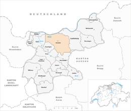
| Surrounded by | Eiken, Frick, Ittenthal, Laufenburg (DE-BW), Laufenburg, Murg (DE-BW), Oeschgen, Sisseln, Sulz | |
| Website |
www SFSO statistics |
|
Kaisten is a municipality in the district of Laufenburg in the canton of Aargau in Switzerland. On 1 January 2010 the municipality of Ittenthal merged into the municipality of Kaisten.
Archeological finds in Kaisten include a Bronze Age burial mound of the Hallstatt period, and a Roman watchtower and brick kiln. Kaisten is first mentioned in 1282 as Keiston. Ittenthal was first mentioned in 1297 as Utendal though this comes from a 15th-century copy of the original. Ittenthal was also mentioned in 1318 as ze Uttendal. Kaisten castle was built in the 12th and 13th centuries and was part of the territory of Säckingen. After the 13th century, it was part of the Austrian Habsburgs land, until 1797. After the annexation of the Fricktal by the Canton of Aargau in the 1803 Act of Mediation it became a municipality.
The Church of St. Michael, founded by Säckingen, was first mentioned in 1443. Until 1804 it was a filial church of the Laufenburg church. The present building dates from 1717. Before 1812 Kaisten and Ittenthal formed a parish.
Economically, vineyards played an important role into the mid-19th century. Throughout the Middle Ages and the early modern age, smelting of iron was also important. In the 20th century, a brick factory was built in Kaisten. Until 1960 Kaisten was mostly a farming village, but it then moved to the chemicals industry.
Kaisten has an area, as of 2009[update], of 14.19 square kilometers (5.48 sq mi). Of this area, 5.86 km2 (2.26 sq mi) or 41.3% is used for agricultural purposes, while 6.38 km2 (2.46 sq mi) or 45.0% is forested. Of the rest of the land, 1.62 km2 (0.63 sq mi) or 11.4% is settled (buildings or roads), 0.3 km2 (0.12 sq mi) or 2.1% is either rivers or lakes and 0.02 km2 (4.9 acres) or 0.1% is unproductive land.
...
Wikipedia


