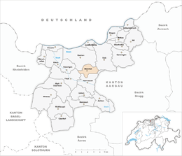
Ittenthal
| Ittenthal | ||
|---|---|---|
| Former municipality of Switzerland | ||
 |
||
|
||
| Coordinates: 47°31′N 8°04′E / 47.517°N 8.067°ECoordinates: 47°31′N 8°04′E / 47.517°N 8.067°E | ||
| Country | Switzerland | |
| Canton | Aargau | |
| District | Laufenburg | |
| Area | ||
| • Total | 3.89 km2 (1.50 sq mi) | |
| Elevation | 404 m (1,325 ft) | |
| Population (December 2006) | ||
| • Total | 201 | |
| • Density | 52/km2 (130/sq mi) | |
| Postal code | 5083 | |
| SFOS number | 4168 | |
| Surrounded by | Frick, Hornussen, Kaisten, Sulz | |
| Website |
www SFSO statistics |
|
Ittenthal was a municipality in the district of Laufenburg in the canton of Aargau in Switzerland. On 1 January 2010, Ittenthal merged into the municipality of Kaisten.
The historical population is given in the following table:
...
Wikipedia


