Kai Tak Station
| Future MTR rapid transit station | |||||||||||
 |
|||||||||||
| Location | Concorde Road, Kai Tak Development Area Kowloon City District, Hong Kong |
||||||||||
| Coordinates | 22°19′49″N 114°11′58″E / 22.3304°N 114.1994°ECoordinates: 22°19′49″N 114°11′58″E / 22.3304°N 114.1994°E | ||||||||||
| Owned by | KCR Corporation | ||||||||||
| Operated by | MTR Corporation | ||||||||||
| Line(s) | |||||||||||
| Platforms | 2 (1 island platform) | ||||||||||
| Tracks | 2 | ||||||||||
| Construction | |||||||||||
| Structure type | Underground | ||||||||||
| Other information | |||||||||||
| Station code | KAT | ||||||||||
| History | |||||||||||
| Opening |
|
||||||||||
| Services | |||||||||||
|
|||||||||||
| Location | |||||||||||
|
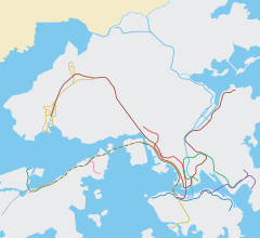
Location within the MTR system
|
|||||||||||
Kai Tak (Chinese: 啟德) is an under-construction underground MTR rapid transit station in Hong Kong on the East West Corridor, located in the Kai Tak Development Area near the old east apron of the former Kai Tak Airport (the station's namesake) in Kowloon City District. The station will provide access to the multi-purpose stadium and other facilities. The station is being built as part of the Sha Tin to Central Link (SCL), and is scheduled to open in 2019 along with the rest of phase 1 of the SCL (Tai Wai–Hung Hom). Before Kai Tak Airport closed, the closest station to it was Diamond Hill.
The station has two levels: a concourse level above a lower level with an island platform. A topping-out ceremony was held on 16 July 2015 to mark completion of major civil works. It was the second SCL station to be topped out, after Hin Keng.
...
Wikipedia

