Kahlotus, Washington
| Kahlotus, Washington | |
|---|---|
| City | |

Kahlotus as seen from the Columbia Plateau Trail.
|
|
| Nickname(s): Hole in The Ground, K-Town | |
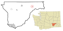
 Location of Kahlotus, Washington |
|
| Coordinates: 46°38′42″N 118°33′18″W / 46.64500°N 118.55500°WCoordinates: 46°38′42″N 118°33′18″W / 46.64500°N 118.55500°W | |
| Country | United States |
| State | Washington |
| County | Franklin |
| Area | |
| • Total | 0.47 sq mi (1.22 km2) |
| • Land | 0.47 sq mi (1.22 km2) |
| • Water | 0 sq mi (0 km2) |
| Elevation | 902 ft (275 m) |
| Population (2010) | |
| • Total | 193 |
| • Estimate (2015) | 190 |
| • Density | 410.6/sq mi (158.5/km2) |
| Time zone | Pacific (PST) (UTC-8) |
| • Summer (DST) | PDT (UTC-7) |
| ZIP code | 99335 |
| Area code(s) | (509)282 |
| FIPS code | 53-34575 |
| GNIS feature ID | 1505893 |
Kahlotus is a city in Franklin County, Washington, United States. The population was 193 at the 2010 census. The Washington State Office of Financial Management's 2015 estimate placed the population at 190.
The first organized settlement of Kahlotus was by German immigrants, imported by the railroads, in around 1880. Among these settlers were several locally recognized pioneer families, including Hans Harder, who first platted the town in 1902 under the name "Hardersburg". The town was later renamed Kahlotus. The meaning of the word "Kahlotus" is uncertain. It is believed by many that it is a Native American word meaning "Hole in the ground", but it may instead mean "stinking water" or "bad water" in reference to the highly alkaline water in the nearby lake. A third possibility is that the town was named for a Palouse tribal chief and signer of the Yakima Treaty of 1855. His name appeared with various spellings, including Kohlotus, Quillatose (by future governor Isaac Stevens), Qalatos, and Kahlatoose.
Harder's platting of the town coincided with the reinstatement of service on the Oregon & Washington Railroad & Navigation line between LaCrosse and Palouse Junction (now Connell), crossing the north end of town parallel to present-day Highway 260. Soon after, the Spokane, Portland & Seattle Railroad began construction on a second railroad on the south shore of nearby Kahlotus lake, including tunnels through the basalt cliffs near the southeast corner of town. Kahlotus was officially incorporated on May 31, 1907. The town boomed during construction of the railroad, local legend claims that nearly 20 saloons, a bank, newspaper, brothels, and other businesses appeared to serve the rail crews.
Dryland farming has historically constituted the majority of the local economy. Relatively little irrigated agriculture occurs in the area, supported by local wells. The Columbia Basin Irrigation Project does not deliver water to Kahlotus.
In 1969, the initial phase of the Lower Monumental Dam was completed nearby, bringing more electricity and water for irrigation, but inundating the nearby Marmes Rockshelter. The dam also made the Snake River navigable, allowing grain to be barged downriver rather than being carried by train. Within a few years, the railroad through the north end of the valley was abandoned and removed. The Burlington Northern tracks along the south end of the lake bed and Devils Canyon were abandoned and removed in the late 1980s, and the right of way became part of the Columbia Plateau Trail State Park.
...
Wikipedia
