
Königsbrück
| Königsbrück | ||
|---|---|---|
 |
||
|
||

Königsbrück
|
||
|
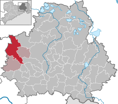
Location of Königsbrück within Bautzen district
  |
||
| Coordinates: 51°15′N 13°53′E / 51.250°N 13.883°ECoordinates: 51°15′N 13°53′E / 51.250°N 13.883°E | ||
| Country | Germany | |
| State | Saxony | |
| District | Bautzen | |
| Municipal assoc. | Königsbrück | |
| Government | ||
| • Mayor | Heiko Driesnack (CDU) | |
| Area | ||
| • Total | 77.83 km2 (30.05 sq mi) | |
| Population (2015-12-31) | ||
| • Total | 4,429 | |
| • Density | 57/km2 (150/sq mi) | |
| Time zone | CET/CEST (UTC+1/+2) | |
| Postal codes | 01936 | |
| Dialling codes | 035795 | |
| Vehicle registration | BZ | |
| Website | www.koenigsbrueck.de | |

Königsbrück (Upper Sorbian: Kinspork) is a town in the Bautzen district, in the Free State of Saxony, Germany. It is situated 14 km (8.7 mi) west of Kamenz, and 27 km (17 mi) northeast of the Saxon capital Dresden. Königsbrück is known as the western gate of the historic Upper Lusatia region.
First mentioned in 1248 the settlement arose around a fortress in the Bohemian crown land of Upper Lusatia where the Via Regia trade route crossed the border with the Margraviate of Meissen. First mentioned as a town in 1331, Königsbrück from 1562 was the administrative centre of a Bohemian state country (Freie Standesherrschaft), which passed under the suzerainty of the Saxon Electorate according to the 1635 Peace of Prague. In 1906 the Kingdom of Saxony had large proving grounds laid out for the XII (1st Royal Saxon) Corps stationed at Dresden, that after World War II were used by the Soviet Army and finally closed in 1992.
...
Wikipedia