Jungfrau
| Jungfrau | |
|---|---|

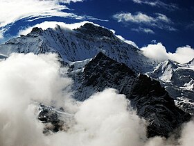
Northern wall
|
|
| Highest point | |
| Elevation | 4,158 m (13,642 ft) |
| Prominence | 692 m (2,270 ft) |
| Isolation | 8.2 km (5.1 mi) |
| Parent peak | Finsteraarhorn |
| Coordinates | 46°32′12.5″N 7°57′45.5″E / 46.536806°N 7.962639°ECoordinates: 46°32′12.5″N 7°57′45.5″E / 46.536806°N 7.962639°E |
| Naming | |
| Translation | Maiden, Vergin (German) |
| Geography | |
| Country | Switzerland |
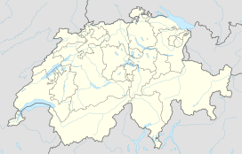
| Cantons | Berne and Valais |
| Parent range | Bernese Alps |
| Topo map | Swisstopo 1249 Finsteraarhorn |
| Climbing | |
| First ascent | 3 August, 1811 by J. Meyer, H. Meyer, A. Volken, J. Bortis |
| Easiest route | basic snow/ice climb |
The Jungfrau ("maiden, virgin") at 4,158 metres (13,642 ft) is one of the main summits of the Bernese Alps, located between the northern canton of Berne and the southern canton of Valais, halfway between Interlaken and Fiesch. Together with the Eiger and Mönch, the Jungfrau forms a massive wall overlooking the Bernese Oberland and the Swiss Plateau, one of the most distinctive sights of the Swiss Alps.
The summit was first reached on August 3, 1811 by the Meyer brothers of Aarau and two chamois hunters from Valais. The ascent followed a long expedition over the glaciers and high passes of the Bernese Alps. It was not until 1865 that a more direct route on the northern side was opened.
The construction of the Jungfrau railway in the early 20th century, which connects Kleine Scheidegg to the Jungfraujoch, the saddle between the Mönch and the Jungfrau, made the area one of the most-visited places in the Alps. Along with the Aletsch Glacier to the south, the Jungfrau is part of the Jungfrau-Aletsch area, which was declared a World Heritage Site in 2001.
Politically, the Jungfrau is split between the municipalities of Lauterbrunnen (Bern) and Fieschertal (Valais). It is the third-highest mountain of the Bernese Alps after the nearby Finsteraarhorn and Aletschhorn, respectively 12 and 8 km away. But from Lake Thun, and the greater part of the canton of Bern, it is the most conspicuous and the nearest of the Bernese Oberland peaks; with a height difference of 3,600 m between the summit and the town of Interlaken. This, and the extreme steepness of the north face, secured for it an early reputation for inaccessibility.
...
Wikipedia

