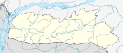
Jowai
|
Jowai Jwai |
|
|---|---|
| town | |
| Location in Meghalaya, India | |
| Coordinates: 25°18′00″N 92°09′00″E / 25.30000°N 92.15000°ECoordinates: 25°18′00″N 92°09′00″E / 25.30000°N 92.15000°E | |
| Country |
|
| State | Meghalaya |
| District | West Jaintia Hills |
| Government | |
| • MLA | Dr. Roy Tre Christopher Laloo (INC) |
| • MP | Mr.Vincent Pala (INC) |
| Elevation | 1,380 m (4,530 ft) |
| Population (2001) | |
| • Total | 25,023 |
| • Density | 77/km2 (200/sq mi) |
| Languages | |
| • Official | Jaintia language English |
| Time zone | IST (UTC+5:30) |
| PIN | 793 150 |
| Telephone code | 91 03652 |
| Vehicle registration | ML-04 |
| Climate | Cwb |
Jowai (IPA: ʤəʊˈwaɪ) is the headquarters of West Jaintia Hills district of the state of Meghalaya, India and is home to the Pnar tribe. It is a scenic place located on a plateau surrounded on three sides by the Myntdu river bordering Bangladesh to the south (about 50 km from the Indo-Bangladesh border). Due to its high altitude of 1380 m above sea level, Jowai experiences warm and pleasant summers with cool to chilly winters.
Jowai is an important business and education hub of the entire district catering to students from all over the district as well as the adjacent parts of Assam and Bangladesh. It is well equipped with amenities such as schools, colleges, hospitals, post office etc.
Jowai is well connected by roadways to Shillong which is 60 km away. The city of Jowai lies on the National Highway 44(NH 44) which connects Assam, Meghalaya, Tripura, Mizoram and parts of Manipur, specifically Lamka (Churachandpur), where the Highway NH 44 is sole link to it.
There are a few buses that ply through this route but are overcrowded with people and goods. The most popular and convenient mode of transport in the district is the Tata Sumo and the Tata Indica that function on a shared passenger basis. The cost for travelling from Shillong to Jowai by either a Tata Sumo or Tata Indica is र100 with a fairly good frequency all through the day.
There is no rail or air link in the district. The nearest and convenient air and rail head serving most destinations is in Guwahati, Assam, about 160 km away. Shillong, the capital city, has a small airport serving limited flights to Kolkata only.
The town does not have much to offer as most of the tourist spots lie a few distances away from town, except for the buzzing market area "Iaw Musiang", one of the oldest in the district. Other attractions include:
Behdeinkhlam, a major festival of the Jaintia takes place during the wet and rainy months of July. It is a festival that lasts 4 days. 'Behdienkhlam' literally means 'to drive away evils and plague'. It is a colourful festival that is celebrated in all parts of Jaintia Hills.Today, the Christians usually do not participate in it, but is celebrated with pomp and show amongst the followers of the traditional religion 'Niamtre'. This Festival is connected with a series of religious rites. People dance on the street to the accompaniment of drum beating and pipe playing. The women do not participate in the dancing but have an important role to play at home by offering sacrificial food to the spirits of the ancestors.
...
Wikipedia


