Johnson, Vermont
| Johnson, Vermont | |
|---|---|
| Town | |

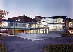
Johnson State College Library and Learning Center
|
|
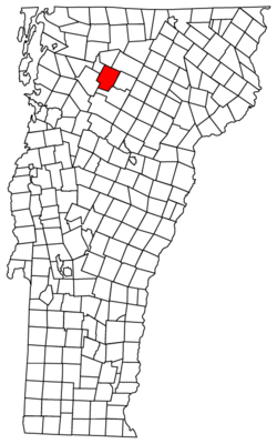
 Located in Lamoille County, Vermont |
|
 Location of Vermont within the U.S.A. |
|
| Location in the United States | |
| Coordinates: 44°38′38″N 74°40′52″W / 44.64389°N 74.68111°WCoordinates: 44°38′38″N 74°40′52″W / 44.64389°N 74.68111°W | |
| Country | United States |
| State | Vermont |
| County | Lamoille |
| Chartered | 1792 (Vermont) |
| Area | |
| • Total | 45.1 sq mi (116.8 km2) |
| • Land | 45.1 sq mi (116.8 km2) |
| • Water | >1 sq mi (>1 km2) 0.02% |
| Population (2012) | |
| • Total | 3,297 |
| • Density | 72.6/sq mi (28.0/km2) |
| • Households | 1,170 |
| • Families | 669 |
| Time zone | EST (UTC-5) |
| • Summer (DST) | EDT (UTC-4) |
| ZIP code | 05656 |
| Area code(s) | 802 |
| GNIS feature ID | 1462129 |
| Website | Johnson Vermont Official Website |
Johnson is a town in Lamoille County, Vermont, United States. The population was 3,274 at the 2000 census. Johnson is home of Johnson State College, a part the Vermont State Colleges system. The Vermont Studio Center is located in the village of Johnson, a part of the town.
According to the United States Census Bureau, the town has a total area of 45.1 square miles (116.8 km2), of which 45.1 square miles (116.8 km2) is land and 0.02% is water.
According to Esther Munroe Swift's book "Vermont Place-names: Footprints of History" the town of Johnson is named for the American jurist, statesman and educator William Samuel Johnson. Johnson, Vermont and a part of neighboring Cambridge, Vermont were together known as King's College Tract being created by a royal charter of British King George III in 1774. The King's College Tract was reserved for the eventual expansion of Kings College in New York, today's Columbia University. After the Declaration of Independence, Vermont's Council of Censors granted the town to Johnson in 1785.
As of the census of 2000, there were 3,274 people, 1,170 households, and 669 families residing in the town. The population density was 72.6 people per square mile (28.0/km2). There were 1,263 housing units at an average density of 28.0 per square mile (10.8/km2). The racial makeup of the town was 96.58% White, 0.61% Black or African American, 0.43% Native American, 0.67% Asian, 0.31% from other races, and 1.41% from two or more races. Hispanic or Latino of any race were 0.73% of the population.
...
Wikipedia

