Jizerské hory
| Jizera Mountains | |
|---|---|
| Jizerky | |

|
|
| Highest point | |
| Peak | Wysoka Kopa |
| Elevation | 1,127 m (3,698 ft) |
| Coordinates | 50°51′1″N 15°25′12″E / 50.85028°N 15.42000°E |
| Geography | |
| Countries | Czech Republic and Poland |
| States | Bohemia and Lower Silesia |
| Range coordinates | 50°50′N 15°15′E / 50.833°N 15.250°ECoordinates: 50°50′N 15°15′E / 50.833°N 15.250°E |
| Parent range | Western Sudetes |
| Geology | |
| Type of rock | Granite and Basalt |
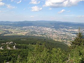
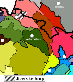
Jizera Mountains (Czech: Jizerské hory) or Izera Mountains (Polish: Góry Izerskie; German: Isergebirge) are part of the Western Sudetes on the border between the Czech Republic and Poland. The range got its name from the Jizera River, which rises at the southern base of the Smrk massif.
The range stretches from the Lusatian Mountains (Zittau Mountains) in the northwest to the Krkonoše in the southeast. The Jizera Mountains comprise the sources of the Jizera river, as well as of the Kwisa and the Lusatian Neisse.
The major part in the south is formed from granite, in the northern part from gneisses and mica schists, with some areas formed from basalt.
The weather conditions are characterized by above-average annual precipitation. On 30 July 1897, the measuring station at Nová Louka recorded a daily precipitation amounting to 345.1 mm (13.6 inches), still an unbroken European record.
The highest peak is Wysoka Kopa (Hinterberg, 1,127 m, 3,698 feet) near the town of Szklarska Poręba in Poland. Neverteheless, a better-known mountain is Smrk (1124 m, 3,688 feet), with a recently rebuilt look-out tower. Other peaks include Jizera (1,122 m, 3,681 feet) and Stóg Izerski (Heufuder, 1,107 m, 3,632). The peaks in order of elevation:
...
Wikipedia

