Jhalokati
|
Jhalokati ঝালকাঠি |
|
|---|---|
| District | |
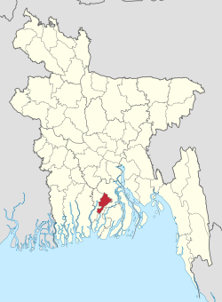
 Location of Jhalokati in Bangladesh |
|
| Coordinates: 22°38′35″N 90°12′00″E / 22.6431°N 90.2000°ECoordinates: 22°38′35″N 90°12′00″E / 22.6431°N 90.2000°E | |
| Country |
|
| Division | Barisal Division |
| Area | |
| • Total | 758.06 km2 (292.69 sq mi) |
| Population (2011 census) | |
| • Total | 682,669 |
| • Density | 900/km2 (2,300/sq mi) |
| Time zone | BST (UTC+6) |
Jhalokati (Bengali: ঝালকাঠি জেলা) is a district in South-western Bangladesh. It is a part of the Barisal Division. With an area of 758.06 km2, Jhalokati is bounded by Barisal district to the north and east, Barguna district and the Bishkhali river in the south, Lohagara Upazila and Pirojpur district to the west. Annual average temperatures: maximum 33.3 °C, minimum 12.1 °C; annual rainfall 2506 mm. Main rivers in this district are Bishkhali, Sugandha, Dhanshiri, Gabkhan, Jangalia and Bamanda, Bajitpur River.
The district is administratively subdivided into 4 upazilas, these are:
Administrator of Zila Porishod: Sarder Mohammad Shah Alam [1]
Deputy Commissioner (DC): Md. Shakhawat Hossain [2]
The district of Jhalokati consists 2475 mosques Dubious - 3 mosques for every km2?, 46 temples and five Buddhist temples.
Between 1940 and 1975, Jhalakati was famous for the only automatic rice huller in the region owned by Shudhangshu Bhushan Das Son of Aswini Kumar Das. It was a thriving complex built on an area approximately 2 square kilometer. The smoke from the chimney served as a navigation landmark by passing steamers while the factory siren could be heard from as far as Barisal. After the company declared bankruptcy in 1975 their descendants eventually migrated to India and other parts of Bangladesh. The massive ruins of the factory can still be seen at west Chandkati.
...
Wikipedia
