Jewell, Kansas
| Jewell, Kansas | |
|---|---|
| City | |
 Location within Jewell County and Kansas |
|
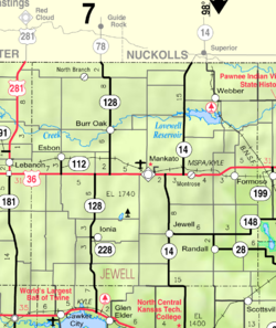
 KDOT map of Jewell County (legend) |
|
| Coordinates: 39°40′15″N 98°9′10″W / 39.67083°N 98.15278°WCoordinates: 39°40′15″N 98°9′10″W / 39.67083°N 98.15278°W | |
| Country | United States |
| State | Kansas |
| County | Jewell |
| Area | |
| • Total | 0.43 sq mi (1.11 km2) |
| • Land | 0.43 sq mi (1.11 km2) |
| • Water | 0 sq mi (0 km2) |
| Elevation | 1,555 ft (474 m) |
| Population (2010) | |
| • Total | 432 |
| • Estimate (2015) | 412 |
| • Density | 1,000/sq mi (390/km2) |
| Time zone | Central (CST) (UTC-6) |
| • Summer (DST) | CDT (UTC-5) |
| ZIP code | 66949 |
| Area code | 785 |
| FIPS code | 20-35475 |
| GNIS feature ID | 0472104 |
Jewell is a city in Jewell County, Kansas, United States. As of the 2010 census, the city population was 432.
The City of Jewell began in 1870 as a large sod enclosure called Fort Jewell. Named in honor of Lieutenant-Colonel Lewis R. Jewell, Sixth Kansas Cavalry, who died November 30, 1862, of wounds received in the battle of Cane Hill, Ark. November 28, 1862.
The first post office in Jewell was established in July 1870.
Jewel was incorporated as a city in 1880.
Jewell was located on the Missouri Pacific Railroad.
A new community center was built in 1999 across from the city park, it features a Public library, American Legion offices and a 4-room hotel.
Jewell is located at 39°40′15″N 98°9′10″W / 39.67083°N 98.15278°W (39.670941, -98.152795). According to the United States Census Bureau, the city has a total area of 0.43 square miles (1.11 km2), all of it land.
As of the census of 2010, there were 432 people, 208 households, and 113 families residing in the city. The population density was 1,004.7 inhabitants per square mile (387.9/km2). There were 251 housing units at an average density of 583.7 per square mile (225.4/km2). The racial makeup of the city was 93.8% White, 1.9% Native American, 0.2% Asian, 0.2% from other races, and 3.9% from two or more races. Hispanic or Latino of any race were 5.6% of the population.
...
Wikipedia
