Jesús María (municipality)
| Jesús María | ||
|---|---|---|
| Municipality | ||
|
||
 Municipality location in Aguascalientes |
||
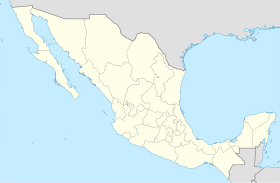
| Location in Mexico | ||
| Coordinates: 21°58′N 102°21′W / 21.967°N 102.350°WCoordinates: 21°58′N 102°21′W / 21.967°N 102.350°W | ||
| Country |
|
|
| State | Aguascalientes | |
| Municipal seat | Jesús María, Aguascalientes | |
| Area | ||
| • Total | 506.32 km2 (195.49 sq mi) | |
| Population (2015) | ||
| • Total | 120,405 | |
| • Density | 240/km2 (620/sq mi) | |
Jesús María is a municipality in the Mexican state of Aguascalientes. It stands at 21°58′N 102°21′W / 21.967°N 102.350°W. The municipality has an area of 499.18 km² (192.73 sq mi).
As of 2010, the municipality had a total population of 99,590.
As of 2010, the city of Jesús María, the municipal seat, had a population of 43,012. Other than the city of Jesús María, the municipality had 346 localities, the largest of which (with 2010 populations in parentheses) were: Jesús Gómez Portugal (Margaritas) (11,589), Paseos de Aguascalientes (4,432), Arboledas Paso Blanco (3,313), Corral de Barrancos (3,158), El Llano (2,571), classified as urban, and Maravillas (2,208), Paso Blanco (1,709), Tepetates (1,683), General Ignacio Zaragoza (Venadero) (1,630), Paseos de las Haciendas (1,596), Valladolid (1,411), San Antonio de los Horcones (1,254), Los Arquitos (1,120), Miravalle (1,071), and Ejido la Guayana (Rancho Seco) (1,028), classified as rural.
...
Wikipedia


