Jervis Bay Territory
|
Jervis Bay Territory Australia |
|||||||
|---|---|---|---|---|---|---|---|
 |
|||||||

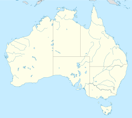
Location of the ACT and Jervis Bay
|
|||||||
| Coordinates | 35°8′55″S 150°42′49″E / 35.14861°S 150.71361°ECoordinates: 35°8′55″S 150°42′49″E / 35.14861°S 150.71361°E | ||||||
| Population | 377 (2011 census) | ||||||
| • Density | 5.6/km2 (15/sq mi) | ||||||
| Established | 1915 | ||||||
| Postcode(s) | 2540 | ||||||
| Area | 67.8 km2 (26.2 sq mi) | ||||||
| Time zone | AEST (UTC+10) | ||||||
| • Summer (DST) | AEDT (UTC+11) | ||||||
| Location | |||||||
| Federal Division(s) | Fenner | ||||||
|
|||||||
The Jervis Bay Territory (/ˈdʒɑːrvᵻs/ or /ˈdʒɜːrvəs/) (abbreviated as JBT) is a territory of the Commonwealth of Australia. It was surrendered by the state of New South Wales to the Commonwealth Government in 1915 so the federal capital at Canberra would have access to the sea.
It was administered by the Department of the Interior (and later by the Department of the Capital Territory) as if it were part of the Australian Capital Territory (ACT), although it has always been a separate Commonwealth territory. The perception that it is part of the ACT stems from the fact that under the terms of the Jervis Bay Territory Acceptance Act, the laws of the ACT apply to the Jervis Bay Territory. In 1989, when the ACT achieved self-government, the Department of The Arts, Sport, The Environment, Tourism and Territories took over responsibility for the JBT's administration, and it has since been administered by various Commonwealth Departments responsible to the Minister for Territories.
The bay was sighted by Lieutenant James Cook aboard HMS Endeavour on 25 April 1770 (two days after Saint George's Day) and he named the southern headland Cape St George.
In August 1791 the bay was entered and named by Lieutenant Richard Bowen aboard the convict transport ship Atlantic of the Third Fleet in honour of Admiral John Jervis, under whom he had served. In November 1791 Master Matthew Weatherhead aboard the Matilda entered the bay to undertake repairs.
...
Wikipedia

