Jernbanetorget
 |
|
| Location |
Jernbanetorget, Oslo Norway |
| Coordinates | 59°54′42″N 10°45′3″E / 59.91167°N 10.75083°ECoordinates: 59°54′42″N 10°45′3″E / 59.91167°N 10.75083°E |
| Elevation | -5.2 m |
| Owned by | Sporveien |
| Operated by | Sporveien T-banen |
| Line(s) | Common Tunnel |
| Distance | 0.5 km from Stortinget |
| Connections |
Train: Oslo S Bus: Oslo Bus Terminal |
| Construction | |
| Structure type | Underground |
| History | |
| Opened | 1966 |
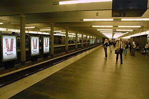
Jernbanetorget is both a rapid transit station on the Oslo Metro and a light rail station of the Oslo Tramway. The metro station is in the Common Tunnel used by all lines under the city centre. It is located between Stortinget to the west and Grønland to the east. Until the construction of the station at Stortinget, Jernbanetorget was the end station for the eastern lines in downtown. Along with the Oslo Central Station, Oslo Bus Terminal and the tram and bus station above ground, Jernbanetorget is the largest transport hub in Norway.
All six of the subway lines pass through the station, totaling 24 departures per hour during most of the day. The station is 0.5 kilometres (0.31 mi) from Stortinget and submerged 5.2 metres (17 ft) below sea level.
It is also the central hub of the Tram network with all six lines using either the platform in front of Christiania Hotel or the one in front of the public transport information centre, Trafikanten.
...
Wikipedia
