Jefferson, New Jersey
| Jefferson Township, New Jersey | |
|---|---|
| Township | |
| Township of Jefferson | |
 Location in Morris County and the state of New Jersey. |
|
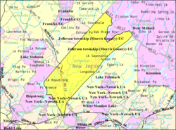
 Census Bureau map of Jefferson Township, New Jersey |
|
| Coordinates: 41°00′10″N 74°33′34″W / 41.002672°N 74.559507°WCoordinates: 41°00′10″N 74°33′34″W / 41.002672°N 74.559507°W | |
| Country |
|
| State |
|
| County | Morris |
| Incorporated | February 11, 1804 |
| Named for | Thomas Jefferson |
| Government | |
| • Type | Faulkner Act (Mayor-Council) |
| • Body | Township Council |
| • Mayor | Russell W. Felter (R, term ends December 31, 2018) |
| • Administrator | James M. Leach |
| • Municipal clerk | Michelle Reilly |
| Area | |
| • Total | 43.108 sq mi (111.651 km2) |
| • Land | 39.132 sq mi (101.353 km2) |
| • Water | 3.976 sq mi (10.298 km2) 9.22% |
| Area rank | 47th of 566 in state 3rd of 39 in county |
| Elevation | 1,142 ft (348 m) |
| Population (2010 Census) | |
| • Total | 21,314 |
| • Estimate (2016) | 21,406 |
| • Rank | 122nd of 566 in state 8th of 39 in county |
| • Density | 544.7/sq mi (210.3/km2) |
| • Density rank | 439th of 566 in state 34th of 39 in county |
| Time zone | Eastern (EST) (UTC-5) |
| • Summer (DST) | Eastern (EDT) (UTC-4) |
| ZIP code | 07435 - Newfoundland 07438 - Oak Ridge 07849 - Lake Hopatcong 07885 - Wharton |
| Area code(s) | 973 |
| FIPS code | 3402734980 |
| GNIS feature ID | 0882210 |
| Website | www |
Jefferson Township is the northernmost township in Morris County, New Jersey, United States. As of the 2010 United States Census, the township's population was 21,314, having increased by 1,597 (+8.1%) from the 19,717 counted in the 2000 Census, which had in turn increased by 1,892 (+10.6%) from the 17,825 counted in the 1990 Census.
Jefferson Township was formed as a township by an act of the New Jersey Legislature on February 11, 1804, from portions of Pequannock Township and Roxbury Township. The township was named after Thomas Jefferson, the President of the United States at the time the Township was created.
According to the United States Census Bureau, the township had a total area of 43.108 square miles (111.651 km2), including 39.132 square miles (101.353 km2) of land and 3.976 square miles (10.298 km2) of water (9.22%).
The township borders Mount Arlington, Rockaway Township, Roxbury Township and Wharton in Morris County; West Milford Township in Passaic County; and Hardyston Township, Hopatcong and Sparta Township in Sussex County.
...
Wikipedia
