Jalostotitlan
| Jalostotitlán | ||
|---|---|---|
| Municipality and Town | ||
|
||
| Etymology: Land Of Sandy Caves" in Nahuatl | ||
| Nickname(s): El Corazón de los Altos de Jalisco, Jalos | ||
| Motto: Prudencia-union-fortaleza | ||
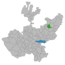
 Location in Jalisco |
||
| Location in Mexico | ||
| Coordinates: 21°10′N 102°28′W / 21.167°N 102.467°WCoordinates: 21°10′N 102°28′W / 21.167°N 102.467°W | ||
| Country |
|
|
| State | Jalisco | |
| Municipality | Jalostotitlán | |
| region | Altos Sur | |
| founded | 1544 | |
| gained the status of a town | 1838 | |
| municipality created | 21 May 1872 | |
| elevated to city stats | 1 September 1970 | |
| Founded by | Fray Miguel de Bologna | |
| Seat | Jalostotitlán | |
| Government | ||
| • Type | Ayuntamiento | |
| • Municipal president |
|
|
| Area | ||
| • Total | 427.06 km2 (164.89 sq mi) | |
| Elevation | 1,763 m (5,784 ft) | |
| Population | ||
| • Total | 71,948 | |
| • Density | 170/km2 (440/sq mi) | |
| Demonym(s) | jalostotitlense | |
| Time zone | Central Standard Time (UTC-6) | |
| • Summer (DST) | Central Daylight Time (UTC-5) | |
| Website | official website | |
Jalostotitlán is a town and municipality located in the northeast corner of the state of Jalisco, Mexico, in a region known as Los Altos.
The municipality shares its border on the north with the municipality of Teocaltiche, the east with the municipality of San Juan de los Lagos, to the south with the municipality of San Miguel El Alto, to the southwest with the municipality of Valle de Guadalupe, and to the west with the municipality of Cañadas de Obregón.
The town is located in a midsection of the country, with semi-desert, arid lands to the north and more fertile lands to the south. Winters are relatively cold and summers are hot and rainy. The municipality also includes the towns of San Nicolás de las Flores, Teocaltitán de Guadalupe, San Gaspar de los Reyes and Mitic. In the center of town are the churches that originate from the 16th century, when the town was first founded. Jalostotitlan it's also known for its great religious center, El Señor de la Luz in the locality of Santa María de la O.
"Jalostotitlán" means "Land Of Sandy Caves" in Nahuatl.
In 1164, the residents of the area (mostly from the Tecuexe and Caxcan tribes) resisted Aztec advances, who had just settled in nearby Teocaltiche for a period of 40 years before moving on to Tenochtitlán.
The Spaniards first arrived in the area during the conquest of Tonalá under Captain Pedro Almíndez Chirino with the 350 Spaniards and 500 Purépecha and Tlaxcaltecs under his control.
...
Wikipedia


