Jacksboro, Texas
| Jacksboro, Texas | |
|---|---|
| City | |

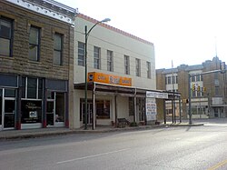
Businesses in downtown Jacksboro
|
|
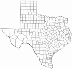
 Location of Jacksboro, Texas |
|
 |
|
| Coordinates: 33°13′24″N 98°9′39″W / 33.22333°N 98.16083°WCoordinates: 33°13′24″N 98°9′39″W / 33.22333°N 98.16083°W | |
| Country | United States |
| State | Texas |
| County | Jack |
| Area | |
| • Total | 6.8 sq mi (17.6 km2) |
| • Land | 5.8 sq mi (15.1 km2) |
| • Water | 1.0 sq mi (2.6 km2) |
| Elevation | 1,083 ft (330 m) |
| Population (2010) | |
| • Total | 4,511 |
| • Density | 778.7/sq mi (300.6/km2) |
| Time zone | Central (CST) (UTC-6) |
| • Summer (DST) | CDT (UTC-5) |
| ZIP code | 76458 |
| Area code(s) | 940 |
| FIPS code | 48-37168 |
| GNIS feature ID | 1338568 |
Jacksboro is a city in Jack County, Texas, in the United States. The population was 4,511 at the 2010 census. Jacksboro is located at the junction of U.S. Highways 281 and 380, and it is the county seat of Jack County.
Jacksboro is located at 33°13′24″N 98°09′39″W / 33.223355°N 98.160845°W (33.223355, -98.160845).
According to the United States Census Bureau, the city has a total area of 6.8 square miles (18 km2), of which, 5.8 square miles (15 km2) of it is land and 1.0 square mile (2.6 km2) of it (14.54%) is water.
Jacksboro was first settled in the 1850s, attracted by land offers from the Texas Emigration and Land Office. Originally called Mesquiteville, the community grew up along the banks of Lost Creek and spread out over the pastureland between Lost Creek and the waters of the West Fork of Keechi Creek. It was renamed Jacksboro in 1858 when it became the county seat, in honor of brothers William and Patrick Jack, veterans of the Texas Revolution. Regular postal service began in 1859.
The county was one of the few to vote against secession before the Civil War. It was devastated by Native American raids until Fort Richardson was built south of Jacksboro in 1870. The population quickly bounced back into the thousands, and the town gained national attention in 1871 when two Kiowa chiefs, Satanta and Big Tree, were tried for murder there.
...
Wikipedia
