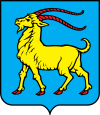
Istria county
|
Istria County Istarska županija (Croatian) Regione istriana (Italian) |
|||
|---|---|---|---|
| County | |||
|
|||
 Istria County within Croatia |
|||
| Country | Croatia | ||
| County seat | Pazin | ||
| Government | |||
| • Župan | Valter Flego (IDS) | ||
| • Assembly |
45 members
|
||
| Area | |||
| • Total | 2,813 km2 (1,086 sq mi) | ||
| Population (2011) | |||
| • Total | 244,278 | ||
| • Density | 87/km2 (220/sq mi) | ||
| Area code | 052 | ||
| ISO 3166 code | HR-18 | ||
| Website | www |
||
Istria County (/ˈɪstriə/; Croatian: Istarska županija; Italian: Regione istriana) is the westernmost county of Croatia which includes the biggest part of the Istrian peninsula (2,820 km2 (1,089 sq mi) out of 3,160 km2 (1,220 sq mi), or 89%). The area of the county is called Istra in Croatian and Slovene. The county administrative center is Pazin and the regional anthem is "Krasna zemljo".
The caves near Pula/Pola (in latinium Pietas Julia), Lim fjord, Šandalja and Roumald's cave, house stone age archaeological remains. Less ancient stone age sites, from the period between 6000-2000 BC, can also be found in the area. More than 400 locations are classified as Bronze Age, (1800 - 1000 BC), items. Numerous findings including weapons, tools, and jewelry), which are from the earlier iron era around the beginning of common era.
The Istrian peninsula was known to Romans as the terra magica. Its name is derived from the Histri, an Illyrian tribe who, as accounted by the geographer Strabo, lived in the region. Romans described them as pirates who were hard to conquer due to the difficulty of navigating their territory. After two military campaigns, Roman legions finally subdued them in 177 BC.
...
Wikipedia


