Ipswich Public Library
| Ipswich, Massachusetts | ||
|---|---|---|
| Town | ||

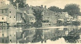
Ipswich riverfront c. 1906
|
||
|
||
| Nickname(s): Birthplace of American Independence | ||
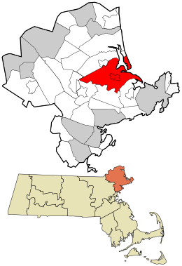
 Location in Essex County and the state of Massachusetts. |
||
| Coordinates: 42°40′45″N 70°50′30″W / 42.67917°N 70.84167°WCoordinates: 42°40′45″N 70°50′30″W / 42.67917°N 70.84167°W | ||
| Country | United States | |
| State | Massachusetts | |
| County | Essex | |
| Settled | 1633 | |
| Incorporated | 1634 | |
| Government | ||
| • Type | Open town meeting | |
| Area | ||
| • Total | 42.5 sq mi (110.1 km2) | |
| • Land | 32.1 sq mi (83.2 km2) | |
| • Water | 10.4 sq mi (26.9 km2) | |
| Elevation | 50 ft (15 m) | |
| Population (2010) | ||
| • Total | 13,175 | |
| • Density | 310/sq mi (120/km2) | |
| Time zone | Eastern (UTC-5) | |
| • Summer (DST) | Eastern (UTC-4) | |
| ZIP code | 01938 | |
| Area code(s) | 351 / 356 / 978 | |
| FIPS code | 25-32310 | |
| GNIS feature ID | 0619448 | |
| Website | www |
|
Ipswich is a coastal town in Essex County, Massachusetts, United States. The population was 13,175 at the 2010 census. Home to Willowdale State Forest and Sandy Point State Reservation, Ipswich includes the southern part of Plum Island. A residential community with a vibrant tourism industry, the town is famous for its clams, celebrated annually at the Ipswich Chowderfest, and for Crane Beach, a barrier beach near the Crane estate. Ipswich was incorporated as a town in 1634.
Ipswich was founded by John Winthrop the Younger, son of John Winthrop, one of the founders of the Massachusetts Bay Colony in 1630 and its first governor, elected in England in 1629. Several hundred colonists sailed from England in 1630 in a fleet of 11 ships, including Winthrop's flagship, the Arbella. Investigating the region of Salem and Cape Ann, they entertained aboard the Arbella for a day, June 12, 1630, a native chief of the lands to the north, Chief Masconomet. The event was recorded in Winthrop's journal on the 13th, but Winthrop did not say how they overcame the language barrier. The name they heard from Masconomet concerning the country over which he ruled has been reconstructed as Wonnesquamsauke, which the English promptly rendered into the anglicized "Agawam". The colonists, however, sailed to the south where some buildings had already been prepared for them at a place newly named Charlestown.
...
Wikipedia

