Plum Island (Massachusetts)

Sand dunes on Plum Island, Massachusetts.
|
|
|
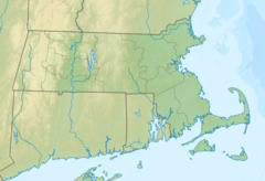
Location of Plum Island in northeastern Massachusetts.
|
|
| Etymology | Named for the preponderance of beach plum thickets on the island. |
|---|---|
| Geography | |
| Location | Atlantic Ocean |
| Coordinates | Barrier island 42°45′20″N 70°47′48″W / 42.75556°N 70.79667°WCoordinates: Barrier island 42°45′20″N 70°47′48″W / 42.75556°N 70.79667°W |
| Length | 11 mi (18 km) |
| Highest point | Sand dunes can reach 50 feet (15 metres) in height above sea level |
| Administration | |
| State |
|
| County | Essex |
| Towns and Cities | Newburyport (city), Newbury (town), Rowley (town), and Ipswich, Massachusetts (town) |
| Additional information | |
| Time zone |
|
| • Summer (DST) |
|
Plum Island is a barrier island located off the northeast coast of Massachusetts, north of Cape Ann, in the United States. It is approximately 11 miles (18 km) in length. The island is named for the wild beach plum shrubs that grow on its dunes. It is located in parts of four municipalities in Essex County. From north to south they are the city of Newburyport, and the towns of Newbury, Rowley, and Ipswich.
Plum Island appears as an unnamed island as early as Captain John Smith's map of New England. Various scholars have speculated on the nature of the earlier accounts of European explorers in the New World, with particular focus on the latter's surveys of the coastlines of Massachusetts, but Smith's account surely identifies Plum Island. He describes a harbor at "Angoam" (elsewhere "Aggawom", the Anglicised Native American name for the native village that preceded Ipswich, Massachusetts, and was destroyed by smallpox) as having "many sands" at its entrance. Before it was an island:
"Morish" is now "marsh", and the high gardens of "mulberry" trees must be beach plum, which prefers the crowns of the dunes, although today can be seen on only a few. The map shows an imaginary English town (the insertion of Charles I of England) of the then-future "South Hampton", about where Newbury is. The Hampton suggestions were later put to use, but further north.
A grant in 1621 by the Plymouth Council for New England, acting under a charter from James I of England (not then reigning) to colonize New England, deeded the land between the "Naumkeag" and Merrimack rivers to Captain John Mason. The island was to be named the Isle of Mason. Mason, then governor of Newfoundland, never acted on the grant. It was later included in a similar grant to the Massachusetts Bay Colony; nevertheless, in 1681 the heirs of John Mason petitioned the General Court of Massachusetts for possession of the grant, now colonized by several communities. After a trial before justices appointed for the purpose, the General Court decided it could not honor the claim, as no one then knew the location of the Naumkeag River, and in any case Mason's grant had been included in another. It did assess a nominal quit-rent fee of a few shillings on land-holders undeniably within the tract; that is, as far south as Ipswich.
...
Wikipedia

