Indian River County, FL
| Indian River County, Florida | ||
|---|---|---|

Indian River County Courthouse in Vero Beach
|
||
|
||
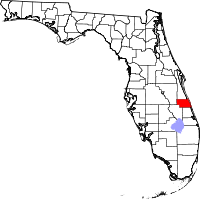
 Location in the U.S. state of Florida |
||
 Florida's location in the U.S. |
||
| Founded | May 30, 1925 | |
| Named for | Indian River Lagoon | |
| Seat | Vero Beach | |
| Area | ||
| • Total | 617 sq mi (1,598 km2) | |
| • Land | 503 sq mi (1,303 km2) | |
| • Water | 114 sq mi (295 km2), 18.5% | |
| Population (est.) | ||
| • (2015) | 147,919 | |
| • Density | 274/sq mi (106/km²) | |
| Congressional district | 8th | |
| Time zone | Eastern: UTC-5/-4 | |
| Website | www |
|
Indian River County is a county located in the Treasure Coast region of the U.S. state of Florida. As of the 2010 census, the population was 138,028. Its seat is Vero Beach. It is Florida's 7th richest county and in 2000 was the 87th richest county in the U.S. by per capita income.
Indian River County comprises the Sebastian-Vero Beach, Florida Metropolitan Statistical Area, which is included in the Miami-Fort Lauderdale-Port St. Lucie, Florida Combined Statistical Area.
Prior to 1821 the area of Indian River County was part of the Spanish colony of East Florida. In 1822 this area became part of St. Johns County, in 1824 it became part of Mosquito County (original name of Orange County).
The Second Seminole War was fought in 1835 and from 1838 to 1839. Fort Vinton was built for this purpose near where the intersection of Florida State Road 60 near 122nd avenue lies today.
In 1844 the county's portion of Mosquito County became part of newly created St. Lucia County. In 1855 St. Lucia County was renamed Brevard County. In 1905 St. Lucie County was formed from the southern portion of Brevard County; in 1925 Indian River County was formed from the northern portion of St. Lucie County. It was named for the Indian River Lagoon, which runs through the eastern portion of the county.
...
Wikipedia

