Imperial, Nebraska
| Imperial, Nebraska | |
|---|---|
| City | |

Downtown Imperial: Broadway, looking north
|
|
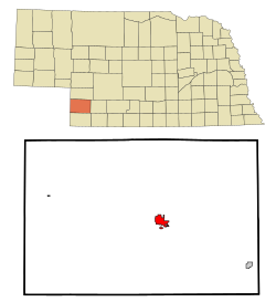
 Location within Chase County and Nebraska |
|
| Coordinates: 40°31′6″N 101°38′33″W / 40.51833°N 101.64250°WCoordinates: 40°31′6″N 101°38′33″W / 40.51833°N 101.64250°W | |
| Country | United States |
| State | Nebraska |
| County | Chase |
| Area | |
| • Total | 2.95 sq mi (7.64 km2) |
| • Land | 2.95 sq mi (7.64 km2) |
| • Water | 0 sq mi (0 km2) |
| Elevation | 3,284 ft (1,001 m) |
| Population (2010) | |
| • Total | 2,071 |
| • Estimate (2013) | 2,091 |
| • Density | 700/sq mi (270/km2) |
| Time zone | Mountain (MST) (UTC-7) |
| • Summer (DST) | MDT (UTC-6) |
| ZIP code | 69033 |
| Area code(s) | 308 |
| FIPS code | 31-23690 |
| GNIS feature ID | 0830263 |
| Website | imperial-ne.com |
Imperial is a city in Chase County, Nebraska, United States. The population was 2,071 at the 2010 census. It is the county seat of Chase County.
The original town of Imperial was built on land homesteaded by Thomas Mercier and M.J. Goodrich. These men gave a town lot to anyone who would put up a building and help to start the town. Mercier was the first postmaster and took office on December 14, 1885.
The railroad right of way was graded to Imperial in 1888. The railroad reached Imperial on August 15, 1892. It was built by a division of the Chicago, Burlington and Quincy Railroad. This line left the main line near Culbertson and terminated in Imperial.
When the grade was completed, the Lincoln Land Company gave lots to all those who would move their buildings to the "Railroad Addition". Nearly all of the buildings were moved south to the future railroad line and the present location of the business district of the town was established.
According to the United States Census Bureau, the city has a total area of 2.95 square miles (7.64 km2), all of it land.
As of the census of 2010, there were 2,071 people, 860 households, and 553 families residing in the city. The population density was 702.0 inhabitants per square mile (271.0/km2). There were 948 housing units at an average density of 321.4 per square mile (124.1/km2). The racial makeup of the city was 88.3% White, 0.1% Native American, 0.1% Asian, 9.6% from other races, and 1.9% from two or more races. Hispanic or Latino of any race were 15.4% of the population.
...
Wikipedia
