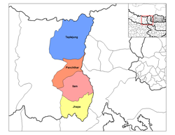
Ilam District
|
Ilam District इलाम जिल्ला |
|
|---|---|
| District | |
 |
|
| Country | Nepal |
| Region | Eastern (Purwanchal) |
| Zone | Mechi |
| Headquarters | Ilam |
| Area | |
| • Total | 1,703 km2 (658 sq mi) |
| Elevation(maximum) | 3,636 m (11,929 ft) |
| Population (2011) | |
| • Total | 290,254 |
| • Density | 170/km2 (440/sq mi) |
| Time zone | NPT (UTC+5:45) |
| Main language(s) | Limbu, Nepali |
| Website | source:Nakul Niroula |
Ilam district (Nepali: ![]() Listen ) is a Hill district of Province No. 1 in eastern Nepal. The district covers 1,703 km2 (658 sq mi). The 2011 census counted 290,254 population.Ilam is the district headquarters, about 600 km (370 mi) from Kathmandu.
Listen ) is a Hill district of Province No. 1 in eastern Nepal. The district covers 1,703 km2 (658 sq mi). The 2011 census counted 290,254 population.Ilam is the district headquarters, about 600 km (370 mi) from Kathmandu.
Illam attracts many researchers who come to study rare birds and the Red Panda. Ilam stretches from the Terai belt to the upper hilly belt of this Himalayan nation.
The name Ilam is derived from the Limbu language in which "Ii" means twisted and "Lam" means road. Illam was one of the ten self ruling states of Limbuwan before the reunification of Nepal. Its ruler King Hangshu Phuba Lingdom of Lingdom dynasty ruled Illam as a confederate state of Limbuwan until 1813 AD. The treaty between the other Limbuwan states and the King of Gorkha (Gorkha-Limbuwan Treaty of 1774 AD) and the conflict of Gorkha and Sikkim led to the unification of Illam with Gorkha. Illam was the last of the ten kingdoms of Limbuwan to be reunified into Nepal. The King of Gorkha gave the ruler of Illam full autonomy to rule and the right of Kipat. Illam was an independent Limbu kingdom until 1813 CE/1869 BS.
...
Wikipedia
