Iklin
|
Iklin L-Iklinow |
|||
|---|---|---|---|
| Local council | |||

Chapel of St. Michael Archangel built in 1615
|
|||
|
|||
 |
|||
| Coordinates: 35°54′15″N 14°27′16″E / 35.90417°N 14.45444°ECoordinates: 35°54′15″N 14°27′16″E / 35.90417°N 14.45444°E | |||
| Country |
|
||
| Region | Central Region | ||
| District | Western District | ||
| Established | 1954 | ||
| Borders | Balzan, Birkirkara, Għargħur, Lija, Naxxar, San Ġwann | ||
| Government | |||
| • Mayor | Anthony Dalli (PN) | ||
| Area | |||
| • Total | 1.7 km2 (0.7 sq mi) | ||
| Population (March 2014) | |||
| • Total | 3,130 | ||
| • Density | 1,800/km2 (4,800/sq mi) | ||
| Demonym(s) | Ikliniż (m), Ikliniża (f), Ikliniżi (pl) | ||
| Time zone | CET (UTC+1) | ||
| • Summer (DST) | CEST (UTC+2) | ||
| Postal code | IKL | ||
| Dialing code | 356 | ||
| ISO 3166 code | MT-19 | ||
| Patron saint |
Holy Family St. Michael |
||
| Day of festa | Sunday before 29 September (St. Michael) | ||
| Website | Official website | ||
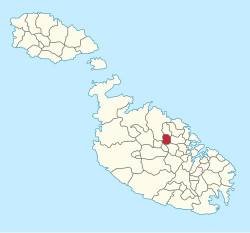
Iklin (Maltese: L-Iklin) is a village in the Central Region of Malta, with a population of 3,130 as of March 2014. Iklin was established in the mid-20th century; however some archaeological sites and a medieval chapel, named as St. Michael Chapel, are proof to earlier settlements. Until recently, the town was considered to form part of Lija. It is bordered by Għargħur, San Ġwann, Birkirkara, Balzan, Lija and Naxxar.
Iklin is divided in Lower Iklin siding on the Birkirkara bypass and the Upper Iklin. In Lower Iklin houses are built side by side, in general villas and maisonettes but also recently some apartments. In Upper Iklin land is on a hill close to Naxxar and land is considered more expensive; in general the land consists of villas and farmhouses. The two sides share two common facts, the neighborhoods structural design and the general silence living areas.
The name of Iklin is derived from the herb Rosmarinus Officinalis, which is known as l-iklin in Maltese. The valley in which the herb grew has now been built up.
Modern day Iklin began to develop in the mid-20th century, but the area still has a few minor sites of archaeological importance. A megalithic site, perhaps the remains of a temple, was discovered in 1967 by the Teenagers Din l-Art Ħelwa group from St. Aloysius' College. Unfortunately, this site has never been seriously surveyed or studied. A second megalithic site was studied in 1986 during works on the new Birkirkara By-Pass, in the area known as Tar-Raddiena. Two large megaliths, and a few smaller ones are still visible (though often ignored) on this busy road. The ruins were dated, through pottery sherds found during excavation, to the Bronze Age. The foundations of a Roman Villa were excavated in 1975 during construction works. The site has had its own historic importance, but it was destroyed soon after the excavations when the development for housing estates proceeded.
...
Wikipedia


