Iizuna, Nagano
|
Iizuna 飯綱町 |
|||
|---|---|---|---|
| Town | |||

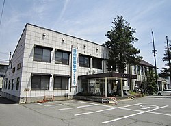
Iizuna Town Hall
|
|||
|
|||
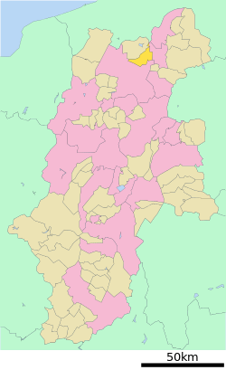
 Location of Iizuna in Nagano Prefecture |
|||
| Coordinates: 36°45′17.2″N 138°14′7.9″E / 36.754778°N 138.235528°ECoordinates: 36°45′17.2″N 138°14′7.9″E / 36.754778°N 138.235528°E | |||
| Country | Japan | ||
| Region | Chūbu (Kōshin'etsu) | ||
| Prefecture | Nagano | ||
| District | Kamiminochi | ||
| Area | |||
| • Total | 75.00 km2 (28.96 sq mi) | ||
| Population (October 2016) | |||
| • Total | 10,895 | ||
| • Density | 145/km2 (380/sq mi) | ||
| Time zone | Japan Standard Time (UTC+9) | ||
| Symbols | |||
| • Tree | Sakura | ||
| • Flower | Apple | ||
| Phone number | 026-253-2511 | ||
| Address | 2795-1 Mure, Iizuna-machi, Kamiminochi-gun, Nagano-ken 389-1293 | ||
| Website | www |
||
Iizuna (飯綱町 Iizuna-machi?) is a town located in Kamiminochi District in south-central Nagano Prefecture, in the Chūbu region of Japan. As of 1 October 2016[update], the town had an estimated population of 10,895 and a population density of 145 persons per km². Its total area was 75.00 square kilometres (28.96 sq mi).
Iizuna is located in northern Nagano Prefecture. It is 13.9 km from east to west and 15.6 km in the south north. The Yaja River that flows from the Mount Reisenji forms the western border of the town which is located on its river terrace. The Torii River flows through the center of town. The Madarao River flows from Shinano, and flows on the north side of this town. It joins the Chikuma River via the Nakano city in the east.
The area of present-day Iizuna was part of ancient Shinano Province. During the Edo period, Mure developed as a post station on the Hokkoku Kaidō highway.
The modern town was created through a merger of the villages of Samizu and Mure on October 1, 2005. Its name comes from Mount Iizuna which dominates the town's western sky.
...
Wikipedia


