Idamalayar Dam
| Idamalayar Dam | |
|---|---|

Idamalayar Dam
|
|
|
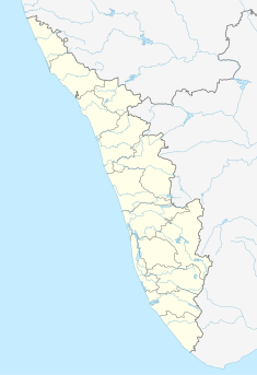
Location of Idamalayar Dam in India Kerala
|
|
| Official name | Idamalayar Dam |
| Country | India |
| Location | Ernakulam District, Kerala |
| Coordinates | 10°13′18″N 76°42′21″E / 10.22167°N 76.70583°ECoordinates: 10°13′18″N 76°42′21″E / 10.22167°N 76.70583°E |
| Construction began | 1970 |
| Opening date | 1985 |
| Construction cost | Rs.539.50 crores (US$ 1.199 billion) |
| Owner(s) | Kerala State Electricity Board |
| Dam and spillways | |
| Type of dam | Gravity dam |
| Impounds | Edamalayar/Periyar river |
| Height | 102.80 metres (337.3 ft) |
| Length | 373 metres (1,224 ft) |
| Reservoir | |
| Creates | Idamalayar Reservoir |
| Total capacity | 1.0898 cubic kilometres (0.2615 cu mi) |
| Catchment area | 381 km2 (147 sq mi) |
| Surface area | 28.3 km2 (10.9 sq mi) |
| Power station | |
| Operator(s) | Kerala State Electricity Board |
| Turbines | 2 x 37.5 MW |
| Installed capacity | 75 MW |
| Annual generation | 380 GW·h |
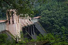
Idamalayar Dam (Malayalam: ഇടമലയാർ അണക്കെട്ട്) is a multipurpose concrete gravity dam located at Ennakal, near Bhoothathankettu, on the Idamalayar River, a tributary of the Periyar River in Kerala, South India. Completed in 1985, with a length of 373 metres (1,224 ft), the dam created a multipurpose reservoir covering 28.3 km2 (10.9 sq mi) in the scenic hills of the Western Ghats.
The reservoir storage is utilized by a hydroelectric power station which has an installed capacity of 75 MW with two units of 37.5 MW capacity, producing an annual energy output of 380 GW·h.
The large reservoir created by the Idamalayar Dam is operated by the Kerala State Electricity Board to augment its peak power generation requirements. The dam will benefit the Idamalayar Irrigation Development Project by diverting water released from the tail race channel of the Idamalayar power station.
The Idamalayar Dam is located on the Idamalayar River, a tributary of the Periyar River in Kerala. Edamalayar originates in the Anamala Hills at elevation of 2,520 metres (8,270 ft). The river is a perennial source draining a catchment area of 381 km2 (147 sq mi) with a topography of high relief. The catchment receives annual rainfall of 6,000 millimetres (240 in), 90% of which occurs during the monsoon months of June to September.
The dam is located 81 kilometres (50 mi) from Ernakulam in Ernakulam district and 10–12 kilometres (6.2–7.5 mi) from the Bhoothathankettu dam (literal meaning in Malayalam language: "monster dam") on the Periyar River, which takes its name from local myths attributing its construction to demons who built it with the intention of submerging Thrikkariyoor temple.
...
Wikipedia

