Iburg
| Bad Iburg | ||
|---|---|---|
|
||
| Coordinates: 52°09′33″N 08°02′50″E / 52.15917°N 8.04722°ECoordinates: 52°09′33″N 08°02′50″E / 52.15917°N 8.04722°E | ||
| Country | Germany | |
| State | Lower Saxony | |
| District | Osnabrück | |
| Government | ||
| • Mayor | Annette Niermann | |
| Area | ||
| • Total | 36.44 km2 (14.07 sq mi) | |
| Elevation | 104 m (341 ft) | |
| Population (2015-12-31) | ||
| • Total | 10,548 | |
| • Density | 290/km2 (750/sq mi) | |
| Time zone | CET/CEST (UTC+1/+2) | |
| Postal codes | 49186 | |
| Dialling codes | 05403 | |
| Vehicle registration | OS | |
| Website | www.badiburg.de | |
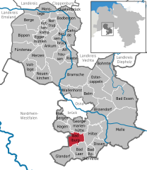
Bad Iburg (Westphalian: Bad Ibig) is a town in the district of Osnabrück, in Lower Saxony, Germany. It is situated in the Teutoburg Forest, 16 km south of Osnabrück.
Bad Iburg is also the name of a municipality which includes the town and four outlying centres: Glane, Ostenfelde, Sentrup and Visbeck.
The most important building is Schloss Iburg above the town. It is a complex of a castle which was the residence of the bishops of Osnabrück for six hundred years and a former monastery of the Order of Saint Benedict.
Bad Iburg was first mentioned in 753 in a Frankish document. In 772 the Frankish King Charlemagne captured the “Royal castle Iburg”, from his chief antagonist, the Saxon leader Widukind. In a lasting period of struggles the ownership changed between Franks and Saxons. Frankish troops finally regained the castle in 783.
Bad Iburg became of more than local importance in the 11th century when Bishop Benno I (1052–1067) built a new castle on the ruins of the first fortification. This castle was also ruined so Benno I's successor Bishop Benno II of Osnabrück (1068–1088) built another castle. He also founded a Benedictine monastery, the first twelve monks came from Mainz. An interesting feature of the Roman Catholic Church of St. Clemens is the hagioscope, which allowed lepers to view the service from outside. Bishop Benno II was buried in St. Clemens, the monastery's church.
...
Wikipedia


