Hyōnosen-Ushiroyama-Nagisan Quasi-National Park
| Hyōnosen-Ushiroyama-Nagisan Quasi-National Park | |
|---|---|
| 氷ノ山後山那岐山国定公園 | |
|
IUCN category V (protected landscape/seascape)
|
|

|
|
|
Location of Hyōnosen-Ushiroyama-Nagisan Quasi-National Park in Japan
|
|
| Location | Kansai Region, Japan |
| Nearest city | Toyooka, Hyōgo Prefecture |
| Coordinates | 35°20′17″N 134°29′2″E / 35.33806°N 134.48389°ECoordinates: 35°20′17″N 134°29′2″E / 35.33806°N 134.48389°E |
| Area | 488.03 square kilometres (188.43 sq mi) |
| Established | April 10, 1969 |
| Governing body | Hyōgo Prefecture, Tottori Prefecture, Okayama Prefecture |
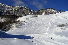
Hyōnosen-Ushiroyama-Nagisan Kokutei Kōen (氷ノ山後山那岐山国定公園?) is a Quasi-National Park in Hyōgo Prefecture, Tottori Prefecture, and Okayama Prefecture, Japan. It was founded on 10 April 1969 and has an area of 488.03 square kilometres (188.43 sq mi).
Hyōnosen-Ushiroyama-Nagisan Kokutei Kōen comprises three areas of the Chūgoku Mountains, a mountain range which forms the backbone of the Chūgoku region of western Japan and extends under the Pacific Ocean. The park covers 48,803 hectares (120,590 acres): 25,200 hectares (62,000 acres) in Hyōgo Prefecture, 15,024 hectares (37,130 acres) in Okayama Prefecture, and 8,579 hectares (21,200 acres) in Tottori Prefecture.
Important mountains of the park include:
...
Wikipedia

