Hurstville City Council
|
Hurstville City Council New South Wales |
|
|---|---|

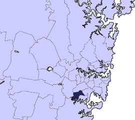
Location in Metropolitan Sydney, 1931–2016
|
|
| Coordinates | 33°58′S 151°06′E / 33.967°S 151.100°ECoordinates: 33°58′S 151°06′E / 33.967°S 151.100°E |
| Population | 80,823 (2011 census) |
| • Density | 3,510/km2 (9,100/sq mi) |
| Established | 25 March 1887 |
| Abolished | 12 May 2016 |
| Area | 23 km2 (8.9 sq mi) |
| Council seat | Civic Centre, Hurstville |
 |
|
| Website | Hurstville City Council |
The Hurstville City Council was a local government area in the St George and southern region of Sydney, New South Wales, Australia. The city centre of Hurstville is located 17 kilometres (11 mi) south–west of Sydney and west of Botany Bay. Hurstville was incorporated as a municipality in 1887, declared a city in 1988, and abolished in 2016.
A 2015 review of local government boundaries by the NSW Government Independent Pricing and Regulatory Tribunal recommended that the Hurstville City Council merge with the Kogarah City Council to form a new council with an area of 38 square kilometres (15 sq mi) and support a population of approximately 147,000. On 12 May 2016 the NSW Government announced that the Hurstville City Council would merge with the neighbouring Kogarah City Council to establish the Georges River Council, with immediate effect.
On 25 March 1887 the NSW Government Gazette published a proclamation declaring the "Municipal District of Hurstville". On 28 June 1900, a further proclamation declared Bexley Ward of Hurstville be separated and named the Borough of Bexley. On 28 June 1900 a new proclamation declared the "Municipality of Hurstville". On 2 August 1922, a part of Hurstville was transferred to the Sutherland Shire, on 5 December 1924 part of Canterbury Municipality was transferred to Hurstville, and on 1 January 1931 part of Hurstville was given to Kogarah Municipality. On 25 November 1988 Hurstville was proclaimed a city, becoming the "Hurstville City Council".
...
Wikipedia
