Huron, New York
| Huron, New York | |
|---|---|
| Town | |
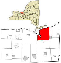
 Location in Wayne County and the state of New York. |
|
| Location within the state of New York | |
| Coordinates: 43°14′24″N 76°53′39″W / 43.24000°N 76.89417°W | |
| Country | United States |
| State | New York |
| County | Wayne |
| Settled | 1796 |
| Established | February 25, 1826 |
| Government | |
| • Type | Town Board |
| • Supervisor | Laurie J. Crane |
| • Clerk | Tammy A. Vezzose |
| • Court | Justice Gary Cantaben Justice Kathy J. Wachtman |
| Area | |
| • Total | 43.2 sq mi (111.9 km2) |
| • Land | 39.5 sq mi (102.3 km2) |
| • Water | 3.7 sq mi (9.5 km2) |
| Elevation | 292 ft (89 m) |
| Population (2010) | |
| • Total | 2,118 |
| • Density | 49.0/sq mi (18.9/km2) |
| Time zone | Eastern (EST) (UTC-5) |
| • Summer (DST) | EDT (UTC-4) |
| Area code(s) | 315 |
| FIPS code | 36-37165 |
| GNIS feature ID | 0979089 |
| Website | http://townofhuron.org/ |
Huron is a town in Wayne County, New York, United States. The population was 2,118 at the 2010 census. The town is named after the Huron Indians.
The Town of Huron is in the northeastern part of the county and is east of Rochester, New York. It has a hamlet, also called Huron. Government offices for the town are located just east of there at Rice Mill.
There is no post office in the Town of Huron. Primary postal districts covering the area include ZIP Code 14590 for Wolcott and ZIP Code 14516 for North Rose.
The town was part of the Pulteney Purchase. It was first settled around 1796.
The Town of Huron was created from the Town of Wolcott in 1826 as the "Town of Port Bay." In 1834, the town's name was changed to honor the Huron tribe.
From 1826 to 1837, a Shaker community was partially located in the town...known today as Shaker Heights. Because they believed that too many worldly influences were appearing in Huron, they moved to the Town of Groveland and established the Groveland Shaker Village, which is now where the Groveland Correctional Facility is located.
According to the United States Census Bureau, the town has a total area of 43.2 square miles (112 km2), of which, 39.5 square miles (102 km2) of it is land and 3.7 square miles (9.6 km2) of it (8.54%) is water.
...
Wikipedia

