Hundred of Curramulka
|
County of Fergusson South Australia |
|||||||||||||||
|---|---|---|---|---|---|---|---|---|---|---|---|---|---|---|---|

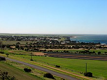
Ardrossan in the Hundred of Cunningham
|
|||||||||||||||
| Coordinates | 34°42′22″S 137°39′22″E / 34.706°S 137.656°ECoordinates: 34°42′22″S 137°39′22″E / 34.706°S 137.656°E | ||||||||||||||
| Established | 1869 | ||||||||||||||
| Area | 4,830 square kilometres (1,864 sq mi) | ||||||||||||||
| LGA(s) | Yorke Peninsula Council | ||||||||||||||
| Region | Yorke and Mid North | ||||||||||||||
|
|||||||||||||||
| Footnotes | Coordinates Adjoining counties |
||||||||||||||
County of Fergusson is a cadastral unit located in the Australian state of South Australia which covers the full extent of Yorke Peninsula south of the town centre in the locality of Price. It was proclaimed in 1869 by Governor Fergusson whom the county was named after by the Government of South Australia.
The County of Fergusson covers the part of Yorke Peninsula “lying to the south of the south boundary of the County of Daly, including Wauraltee Island” where the southern boundary of the County of Daly approximately aligns with the town centre in the locality of Price.
The County of Fergusson was proclaimed by Sir James Fergusson, 6th Baronet, the eighth Governor of South Australia on 18 February 1869 along with three of its constituent hundreds, the Hundreds of Melville, Moorowie and Para Wurlie. The county was named by the Government of South Australia after Sir James Fergusson who was the Governor of South Australia from 1869 to 1873.
The following sixteen hundreds were proclaimed within the County between the years 1869 and 1878 - Carribie and Coonarie in 1878, Cunningham in 1873, Curramulka in 1874, Dalrymple and Kilkerran in 1872, Koolywurtie in 1874, Maitland in 1872, Melville in 1869, Minlacowie in 1874, Moorowie in 1869, Muloowurtie in 1874, Para Wurlie in 1869, Ramsay in 1872, Warrenben in 1878 and Wauraltee in 1874.
The hundreds located within the County of Fergusson are laid out as follows:
The Hundred of Carribie (35°00′01″S 137°03′58″E / 35.0004°S 137.066220°E) was proclaimed on 24 January 1878. It covers an area of 350 square kilometres (137 sq mi) and its name is reported as being derived from an aboriginal word meaning “Emu Flat.”
...
Wikipedia

