Ardrossan, South Australia
|
Ardrossan South Australia |
|||||||||||||
|---|---|---|---|---|---|---|---|---|---|---|---|---|---|

Ardrossan and coastline viewed from a lookout
|
|||||||||||||
| Coordinates | 34°25′0″S 137°54′0″E / 34.41667°S 137.90000°ECoordinates: 34°25′0″S 137°54′0″E / 34.41667°S 137.90000°E | ||||||||||||
| Population | 1,136 (2011 census) | ||||||||||||
| Established | 1873 | ||||||||||||
| Postcode(s) | 5571 | ||||||||||||
| Elevation | 23 m (75 ft) | ||||||||||||
| Location | 149 km (93 mi) North West of Adelaide via |
||||||||||||
| LGA(s) | Yorke Peninsula Council | ||||||||||||
| State electorate(s) | Goyder | ||||||||||||
| Federal Division(s) | Grey | ||||||||||||
|
|||||||||||||
|
|||||||||||||
| Footnotes | Climate Adjoining localities |
||||||||||||
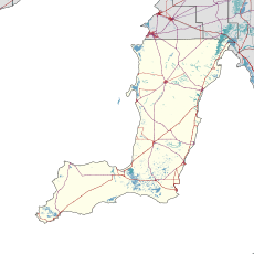
Ardrossan is a town in the Australian state of South Australia located on the east coast of the Yorke Peninsula, about 150 kilometres (93 mi) by road from the Adelaide city centre, It is notable for its deepwater shipping port and its towering coastal cliffs of red clay.
The first European settlers were pastoralists who established sheep runs. Pastoral Lease No. 232, comprising 27 sq. miles, was taken up in 1852 by William Sharples. Stretching along the coastline, this was known as Parara (or Parrana/Pirana), meaning 'middle' in Narungga language, with the homestead near Parara Landing, about three kilometres south of present Ardrossan. Northward of Ardrossan are coastal springs, named Tiddy Widdy or Tittiwitti by the Narungga, being a scarce natural source of fresh water in this region.
In 1859 partners Parker Bowman (1831-1911) and Edmund Parnell (c.1834-87) took over the Parara leases. After these expired in 1865 the government moved toward establishing closer settlement and grain farming.
The Hundred of Cunningham was proclaimed 19 June 1873, comprising 134 square miles, and surveying commenced. The Hundred had two government surveyed towns, namely Ardrossan, proclaimed 13 November 1873, and Price, proclaimed 3 August 1882.
Being at a site formerly known as Clay Gully, after a deep gully leading to its red clay coastal cliffs, the surveyed town of Ardrossan was named by Governor Fergusson after the Ardrossan seaport in Scotland which shared similar geography - 'ard' a height, and 'ros' prominent rock or headland.
The site was largely chosen because of its potential for shipping infrastructure, allowing wheat farmers to ship their produce across the Gulf St Vincent to Port Adelaide. The residents of the new township petitioned the government for a jetty in 1874. Completed in 1877, this was later extended to better accommodate the larger steamships and windjammers used to export grain overseas. By 1878 there were six houses, a post office, a flour mill, a Methodist church, and a hotel. That same year a public school opened, having 53 pupils.
...
Wikipedia

