Huber Heights, Ohio
| Huber Heights, Ohio | |
|---|---|
| City | |

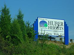
Huber Heights welcome sign with the phrase, "Come Grow With Us!"
|
|
| Nickname(s): Brick City, Huber | |
| Motto: Come Grow With us! | |
 Location in Montgomery County and the state of Ohio. |
|
| Coordinates: 39°51′3″N 84°7′39″W / 39.85083°N 84.12750°WCoordinates: 39°51′3″N 84°7′39″W / 39.85083°N 84.12750°W | |
| Country | United States |
| State | Ohio |
| Counties | Montgomery, Miami, Greene |
| Government | |
| • Mayor | Tom McMasters (D) |
| • City manager | Robert Schommer |
| Area | |
| • Total | 22.37 sq mi (57.94 km2) |
| • Land | 22.27 sq mi (57.68 km2) |
| • Water | 0.10 sq mi (0.26 km2) |
| Elevation | 932 ft (284 m) |
| Population (2010) | |
| • Total | 38,101 |
| • Estimate (2012) | 38,129 |
| • Density | 1,710.9/sq mi (660.6/km2) |
| Time zone | Eastern (EST) (UTC-5) |
| • Summer (DST) | EDT (UTC-4) |
| ZIP code | 45424 |
| Area code(s) | 937 |
| FIPS code | 39-36610 |
| GNIS feature ID | 1048856 |
| Website | www |
Huber Heights is a city in Montgomery, Miami and Greene counties in the U.S. state of Ohio. Huber Heights' motto is "America's largest community of brick homes." The city is named for Charles Huber, the developer who constructed a number of the houses that would later comprise the city. Suburban development began in the area in 1956. The former Wayne Township, now defunct, incorporated as the City of Huber Heights on January 23, 1981. Huber Heights continued to grow by annexing parcels in Miami and Greene counties. Huber Heights is the third largest suburb in the Dayton Metropolitan Statistical Area by population, behind Kettering with 56,163, and Beavercreek with 45,193. Huber Heights' current mayor is Tom McMasters. The population of Huber Heights was 38,101 at the 2010 census.
Most of Huber Heights is in Montgomery County, while the city has more recently annexed land in Miami County. One small parcel of the city is located in Greene County.
According to the United States Census Bureau, the city has a total area of 22.37 square miles (57.94 km2), of which 22.27 square miles (57.68 km2) is land and 0.10 square miles (0.26 km2) is water.
The city developed northeast of Dayton on land between the Great Miami River and the Mad River. State Routes 202 (Old Troy Pike) and 201 (Brandt Pike) serve as the main north-south arteries, while Shull Rd., Executive Blvd., Interstate 70, Taylorsville, Chambersburg, and Fishburg Roads serve as the main east-west arteries. The bulk of the city lies between Needmore Road to the south and Interstate 70 to the North. Recent development has expanded the boundaries of the city north into Miami County near National Road.
...
Wikipedia
