Huallaga Valley
| Huallaga River | |
|
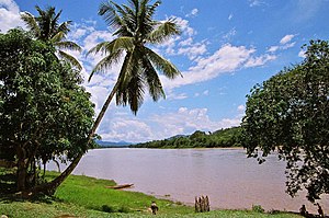
A view of the Huallaga
|
|
| Country | Peru |
|---|---|
| Regions | Huánuco Region, Loreto Region, Pasco Region, San Martín Region |
| Mouth | Marañón River |
| Length | 1,080 km (671 mi) |
| Discharge | |
| - average | 3,800 m3/s (134,196 cu ft/s) |
|
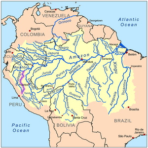
Map of the Amazon Basin with the Huallaga River highlighted
|
|
The Huallaga River is a tributary of the Marañón River, part of the Amazon Basin. Old names for this river include Guallaga and Rio de los Motilones. The Huallaga is born on the slopes of the Andes in central Peru and joins the Marañón before the latter reaches the Ucayali River to form the Amazon. Its main affluents are the Monzón, Mayo, Biabo, Abiseo and Tocache rivers. Coca is grown in most of those valleys, which are also exposed to periodic floods.
Although it runs for 700 miles (1,100 km), it remains unnavigable for most part. For nearly its entire length the Huallaga is an impetuous torrent running through a succession of gorges. It has forty-two rapids (pongos) and it crosses the Andes, forming the Pongo de Aguirre gorge. From this point, 140 miles (230 km) from the Amazon, the Huallaga can be ascended by larger river boats (lanchas) to the port city of Yurimaguas, Loreto.
Although there are no defined boundaries, the river is commonly divided into two or three sections. From the town of Tocache in San Martin to the source of the river is generally referred to as the Upper Huallaga. Regions of the river are also referred to as central Huallaga (usually from Tocache or Juanjui to Chazuta), and the lower Huallaga (usually from Chazuta to Yurimaguas where the Huallaga meets the Marañon). These divisions are for general reference, and are independent of the "highland" and "lowland" jungle regions of the Amazon Rainforest.
Between the Huallaga and the Ucayali lies the famous "Pampa del Sacramento," a level region of stoneless alluvial lands covered with thick, dark forests, first entered by Christian missionaries in 1726. It is about 300 miles (480 km) long, from north to south, and varies in width from 40 to 100 kilometers. Many streams, navigable for canoes, penetrate this region from the Ucayali and the Huallaga. In addition to peasants, it is still occupied by many indigenous communities, such as the Cocama-Cocamilla.
...
Wikipedia


