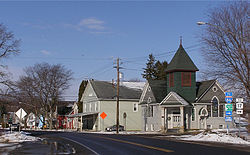
Howard, New York
| Howard, New York | |
|---|---|
| Town | |

Howard, New York
|
|
| Location within the state of New York | |
| Coordinates: 42°20′41″N 77°30′56″W / 42.34472°N 77.51556°W | |
| Country | United States |
| State | New York |
| County | Steuben |
| Area | |
| • Total | 60.7 sq mi (157.3 km2) |
| • Land | 60.6 sq mi (157.1 km2) |
| • Water | 0.1 sq mi (0.3 km2) |
| Elevation | 1,588 ft (484 m) |
| Population (2000) | |
| • Total | 1,467 |
| • Density | 23.6/sq mi (9.1/km2) |
| Time zone | Eastern (EST) (UTC-5) |
| • Summer (DST) | EDT (UTC-4) |
| FIPS code | 36-35837 |
| GNIS feature ID | 0979082 |
Howard is a town in Steuben County, New York, United States. The population was 1,467 at the 2010 census.
The Town of Howard is in the west-central part of the county, east of Hornell, New York.
The town was first settled around 1803, but not permanently settled until after that date. The town was formed in 1812 from parts of the Towns of Bath and Dansville. In turn, Howard contributed some of its territory to form part of the Towns of Avoca (1843) and Fremont (1854).
According to the United States Census Bureau, the town has a total area of 60.7 square miles (157 km2), of which, 60.6 square miles (157 km2) of it is land and 0.1 square miles (0.26 km2) of it (0.16%) is water.
Interstate 86 passes across the north half of the town. Exit 35 is located in the town of Howard itself.
As of the census of 2010, there were 1,467 people, The population density was 23.6 people per square mile (9.1/km²). There were 788 housing units at an average density of 11.6 per square mile (4.5/km²). The racial makeup of the town was 97.7% White, 0.4% African American, 0.2% Native American, 0.07% Pacific Islander, 0.49% from other races, and 0.42% from two or more races. Hispanic or Latino of any race were 0.70% of the population.
...
Wikipedia

